

- Usage in publication:
-
- Osiris Formation
- Modifications:
-
- First used
- Geochronologic dating
- AAPG geologic province:
-
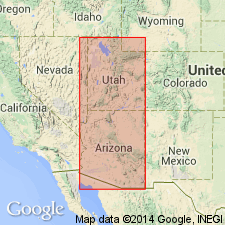
- Paradox basin
Summary:
First use of the Osiris Formation. Also referred to as pre-Isom (Osiris) Formation. Age is [Miocene] based on a radiometric (K-Ar; sanidine) age of 20.3 +/-0.5 Ma.
Source: GNU records (USGS DDS-6; Menlo GNULEX).
- Usage in publication:
-
- Osiris Tuff*
- Modifications:
-
- Named
- Dominant lithology:
-
- Tuff
- AAPG geologic province:
-
- Paradox basin
- Wasatch uplift
- Great Basin province
Summary:
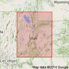
Named for exposures in Black Canyon south of Antimony near the village of Osiris along east fork of Sevier River, Garfield Co, UT in Paradox basin. Type section is east of UT State Hwy 22 in Black Canyon, SW1/4 NW1/4 sec 2, T32S, R2W. Formerly called tuff of Osiris. Overlies alluvial facies or vent facies of Mount Dutton Formation. Underlies Dry Hollow Formation or older basalt flows. Correlation chart; block diagram; measured sections. Is a distinctive compound ash-flow cooling unit. Has a basal black vitrophyre and an overlying thick reddish to chocolate-brown welded devitrified zone and a gray vapor-phase zone at type. Classified as a plagioclase-sanidine vitric welded tuff. Is about 10 m thick at type. Is more than 60 m thick near Salina. Has been mapped in the southern Tushar Mountains, Markagunt, southern Sevier, Awapa, Fish Lake, and Aquarius Plateaus in the Paradox basin, on the Wasatch uplift, and in the Great Basin province. Believed to have been erupted from the Marysvale center. Is of early to middle Miocene age based on five radiometric age determinations that range from 20.3 +/-0.5 m.y. to 22.8 +/-0.4 m.y.
Source: GNU records (USGS DDS-6; Denver GNULEX).
For more information, please contact Nancy Stamm, Geologic Names Committee Secretary.
Asterisk (*) indicates published by U.S. Geological Survey authors.
"No current usage" (†) implies that a name has been abandoned or has fallen into disuse. Former usage and, if known, replacement name given in parentheses ( ).
Slash (/) indicates name conflicts with nomenclatural guidelines (CSN, 1933; ACSN, 1961, 1970; NACSN, 1983, 2005, 2021). May be explained within brackets ([ ]).