The National Geologic Map Database is migrating to a new infrastructure. We apologize for any service disruptions during this process.
|
|---|


- Usage in publication:
-
- Oscar Group
- Modifications:
-
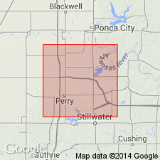
- Areal extent
- Age modified
- AAPG geologic province:
-
- Chautauqua platform
Summary:
Pg. 5-12, 24, Appendix. Oscar Group. Preferred name of the Oklahoma Geol. Survey rather than Kansas names Council Grove and Chase. Described from Noble County, central northern Oklahoma. Includes (descending) Herington Limestone, Enterprise Shale, Winfield Limestone, Doyle Shale, Fort Riley Limestone, Matfield Shale, Wreford Limestone, Garrison Shale, and, in subsurface, Witney (Hodges) sand, Cottonwood Limestone, Hotson sand, and Neva Limestone. Total thickness about 650 feet; outcrop thickness about 300 feet. Overlies Vanoss Group (in subsurface); underlies Sumner Group. Age is latest Pennsylvanian (Gearyan), based on fossil data (see Branson, 1962; Wilson and Rashid [abs.], 1971; Clendening [abs.], 1971); previously considered earliest Permian.
Source: Publication.
For more information, please contact Nancy Stamm, Geologic Names Committee Secretary.
Asterisk (*) indicates published by U.S. Geological Survey authors.
"No current usage" (†) implies that a name has been abandoned or has fallen into disuse. Former usage and, if known, replacement name given in parentheses ( ).
Slash (/) indicates name conflicts with nomenclatural guidelines (CSN, 1933; ACSN, 1961, 1970; NACSN, 1983, 2005, 2021). May be explained within brackets ([ ]).