The National Geologic Map Database is migrating to a new infrastructure. We apologize for any service disruptions during this process.
|
|---|


- Usage in publication:
-
- Ortega quartzite
- Modifications:
-
- Original reference
- Dominant lithology:
-
- Quartzite
- Schist
- AAPG geologic province:
-
- Southern Rocky Mountain region
Summary:
Pg. 11, 13 (table 1), 21-22. 43, pls. 2, 3. Ortega quartzite. Divisible into quartzitic and quartz-muscovite schistose phases. Essentially quartzite which is typically white to bluish gray. Includes Petaca schist phase, local conglomeratic phases, and several of Vallecitos rhyolites (new) in Petaca area, and Rinconada schist phase (new), and some of Picuris basalts particularly near base in Picuris area. Ranges from 2 to 5 miles in thickness. Lies above Hopewell series. Succeeded by Hondo slate in Picuris area. [Age is Precambrian (Proterozoic).]
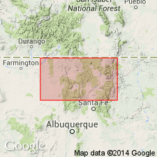
Widely exposed in Petaca area, including Ortega Mountain type area, and in Picuris area, Rio Arriba and Taos Cos., [Carson National Forest area], central northern NM.
Source: US geologic names lexicon (USGS Bull. 1200, p. 2858).
- Usage in publication:
-
- Ortega formation
- Modifications:
-
- Redescribed
- Revised
- Dominant lithology:
-
- Quartzite
- Schist
- Phyllite
- Gneiss
- AAPG geologic province:
-
- Southern Rocky Mountain region
Summary:
Pg. 6-21, pl. 1. Ortega formation. In Picuris Range area, Taos County, central northern New Mexico, consists of three members (ascending): (1) lower quartzite member, coarse-grained quartzite with thin beds of sillimanite-kyanite gneiss, 2,500+ feet (base not exposed here); (2) Rinconada schist member, hornfels, gneiss and schist, quartzite, and phyllite, 1,800+/- feet; and (3) Pilar phyllite member (new; formerly †Hondo slate of Just, 1937), gray-black carbonaceous quartz-muscovite phyllite with slaty cleavage, 2,300+ feet. Total estimated thickness 6,600 feet (formation is extensively folded). Unconformably underlies Vadito formation (new). [Age is Precambrian (Proterozoic).]
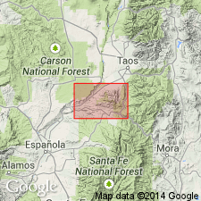
[The Picuris Mountains are along boundary between Cristoval de la Serna Grant and Carson National Forest area, in Taos SW, Penasco, and Tres Ritos 7.5-min quadrangles, Taos Co., central northern NM (USGS historical topographic map collection TopoView, accessed June 8, 2014).]
Source: Publication; US geologic names lexicon (USGS Bull. 1200, p. 2858).

- Usage in publication:
-
- Ortega quartzite
- Modifications:
-
- Revised
- AAPG geologic province:
-
- Southern Rocky Mountain region
Summary:
Pg. 10 (table 2), 11-14, pl. 1. Ortega quartzite. Redefined to include only quartzite that is stratigraphically equivalent to quartzite in Ortega Mountains (cited as Just's type area) and to overlying quartzite that extends up to, but does not include Big Rock conglomerate member (new) of Kiawa formation. Petaca schist separately mapped. [Age is Precambrian (Proterozoic).]
Source: US geologic names lexicon (USGS Bull. 1200, p. 2858).
- Usage in publication:
-
- Ortega Formation
- Modifications:
-
- Revised
- AAPG geologic province:
-
- Southern Rocky Mountain region
Summary:
Ortega Formation revised--Rio Pueblo Schist named as an unranked unit in lower quartzite member of Ortega in this report. Rio Pueblo is exposed near bridge over Rio Pueblo Creek, a mi southeast of village of Rio Pueblo, Rio Arriba Co, NM in Southern Rocky Mountain region, where it extends to south for about 1 mi. Similar rock makes up all of a small hill 1/2 mi northwest of U.S. Hill and northerly part of adjacent larger hill to north. Mapped as a separate migmatitic unit because this rock is so distinct from normal Ortega quartzite. Rio Pueblo may represent granitized arkosic quartzite, but in large part appears to consist of granitic material intruded into and probably intermixed with quartzite. Is of Precambrian age. Geologic map.
Source: GNU records (USGS DDS-6; Denver GNULEX).
- Usage in publication:
-
- Ortega Quartzite*
- Modifications:
-
- Revised
- AAPG geologic province:
-
- Southern Rocky Mountain region
Summary:
Pg. A13, A21-A22. Ortega Quartzite of Barker (1958) adopted by the USGS. Restricted to Just's (1937) lower 14,000 to 20,000 feet-thick sequence. Consists of quartzite and conglomerate. Underlies Kiawa Mountain Formation; base not exposed. Age is Precambrian.
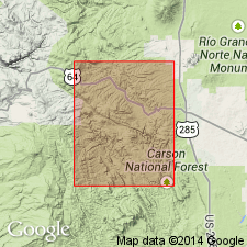
[Notable exposure southwest of Las Tablas], in center sec. 25, T. 27 N., R. 8 E., [Las Tablas 7.5-min quadrangle, Rio Arriba Co., Carson National Forest area, central northern NM].
Source: Publication.
- Usage in publication:
-
- Ortega Quartzite*
- Modifications:
-
- Principal reference
- Revised
- AAPG geologic province:
-
- Southern Rocky Mountain region
Summary:
Pg. 12 (fig. 4), 14, 16 (table 1). Ortega Quartzite. Suggests name be applied to all quartzite and quartz-pebble conglomerate horizons in the Tusas Mountains region [between Chama and Ojo Caliente, Rio Arriba County, central northern New Mexico]. Revised to include upper quartzite member formerly assigned to †Kiawa Mountain Formation (abandoned) and exclude †Petaca Schist (abandoned). Age is Precambrian. Barker's (1958) classification re-ordered; the Ortega is considered younger than Burned Mountain Metarhyolite and Moppin Metavolcanics. Principal reference locality designated. (The type locality of Barker, 1970, is inappropriate; entire section underlain by the †Petaca.)
Principal reference locality: about 3.5 mi south-southeast of village of Vallecitos in a canyon of the Rio Vallecitos, in east-central part of sec. 34, T. 26 N., R. 8 E., La Madera 7.5-min quadrangle, Rio Arriba Co., [Carson National Forest area], central northern NM.
Source: Publication.
- Usage in publication:
-
- Ortega Formation
- Modifications:
-
- Reference
- AAPG geologic province:
-
- Southern Rocky Mountain region
Summary:
Pg. 46 (table 1), 50. Ortega Formation of Hondo Group. Is basal formation of Hondo Group, overlying the immature transitional metasediments of the Vadito Group; base of Ortega placed at lowermost massive quartzite. Underlies the pelitic schist of the Rinconada Formation of Hondo Group; top of Ortega placed at uppermost massive pure quartzite. Age is considered Early Proterozoic, younger than 1,700 Ma.
Reference sections: (1) Ortega Mountains, Brazos uplift, Rio Arriba Co., where unit was originally described; (2) cliffs near Pilar, northern Picuris Mountains, Taos Co., where base is exposed; (3) Jawbone syncline, northern Tusas Mountains, Rio Arriba Co., where original sedimentary structures are well preserved (Soegaard and Eriksson, 1985, Jour. Geol., v. 94, no. 1, p. 47-66); and (4) Rattlesnake Canyon, south end of Copper Hill, south-central Picuris Mountains, where uppermost quartzite, incl. the kyanite and andalusite schist/quartzite described by Williams (1982, unpub. MS thesis, Univ. Arizona) is exposed.
Principal reference section (Hondo Group): Hondo Canyon area, in secs. 29 and 32, T. 24 N., R. 12 E., Taos SW 7.5-min quadrangle, Taos Co., northern Picuris Mountains, [Carson National Forest area], central northern NM.
Source: Publication.
- Usage in publication:
-
- Ortega Quartzite*
- Modifications:
-
- Geochronologic dating
- AAPG geologic province:
-
- Southern Rocky Mountain region
Summary:
Basal formation of Hondo Group whose depositional age is between 1,690 and 1,710 Ma. Age of this formation in north-central NM in the Southern Rocky Mountain region is based on 1.) light-colored, euhedral to subhedral populations of zircon from the Ortega in the Tusas Mountains and Picuris Range that suggest provenance of about 1,710 Ma, 2.) 1,700 Ma age of rhyolite beneath Ortega in the Tusas Mountains, and 3.) age of a stock dated at about 1,690 which cuts the Hondo Group in central NM.
Source: GNU records (USGS DDS-6; Denver GNULEX).
For more information, please contact Nancy Stamm, Geologic Names Committee Secretary.
Asterisk (*) indicates published by U.S. Geological Survey authors.
"No current usage" (†) implies that a name has been abandoned or has fallen into disuse. Former usage and, if known, replacement name given in parentheses ( ).
Slash (/) indicates name conflicts with nomenclatural guidelines (CSN, 1933; ACSN, 1961, 1970; NACSN, 1983, 2005, 2021). May be explained within brackets ([ ]).