

- Usage in publication:
-
- Orindan formation
- Modifications:
-
- Original reference
- Dominant lithology:
-
- Conglomerate
- Sandstone
- Shale
- Clay
- Limestone
- Tuff
- AAPG geologic province:
-
- Sacramento basin
Summary:
Pg. 371 and map. Orindan formation. Fresh-water conglomerates, sandstones, shales, clays, limestones, and tuffs, with pebble conglomerate at base. Thickness 800 to more than 2,400 feet. Basal formation of Berkeleyan series. Rests on Monterey series and is overlain by rhyolite tuff that forms basal division of Upper Berkeleyan. [Age is Pliocene.]
Source: US geologic names lexicon (USGS Bull. 896, p. 1560-1561).
- Usage in publication:
-
- Orinda formation*
- Modifications:
-
- Principal reference
- Revised
- Dominant lithology:
-
- Conglomerate
- Sandstone
- Shale
- Limestone
- AAPG geologic province:
-
- Sacramento basin
Summary:
Orinda formation. Fresh-water conglomerates, sandstone, clay shales, limestones, some thin seams of lignite, and at a few horizons thin layers of brown decomposed volcanic tuff. Farther east, in Mount Diablo quadrangle, it includes, in lower part, a few beds of pumiceous tuff similar to Pinole tuff. Thickness 2,000 to 2,500 feet in San Pablo Ridge, but 6,000 feet to southeast, near southern border of Concord quadrangle. Lies conformably on Pinole tuff, or, where that is absent, rests on San Pablo or older formations. Excluded from Berkeley group. Is overlain by Moraga formation, which in now treated as basal division of Berkeley group. [Age is Pliocene.]
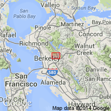
Named from exposures at Orinda, Contra Costa Co., San Francisco region, western CA.
Source: US geologic names lexicon (USGS Bull. 896, p. 1560-1561).
- Usage in publication:
-
- Orinda formation*
- Modifications:
-
- Age modified
- AAPG geologic province:
-
- Sacramento basin
Summary:
Orinda formation. Assigned the Orinda to lower Pliocene.
Source: US geologic names lexicon (USGS Bull. 896, p. 1560-1561).
- Usage in publication:
-
- Orinda formation
- Modifications:
-
- Areal extent
- AAPG geologic province:
-
- Northern Coast Range province
- Sacramento basin
Summary:
Pg. 1035, pl. 88 (geol. map). Orinda formation. Continental deposits. Thickness 3,000 feet. Stratigraphic sequence on south side of Riggs Canyon fault zone, Mount Diablo area, [Mount Diablo quadrangle, Contra Costa and Alameda Counties, western California], shows Orinda formation below Moraga tuff and above Jacalitos(?). Age is Pliocene.
[Misprint (US geologic names lexicon, USGS Bull. 1200, p. 2852): article was published in 1935, not 1936; pl. 88 shows the Orinda in direct contact with the Moraga, not 3,060 feet below it.]
Source: Publication; US geologic names lexicon (USGS Bull. 1200, p. 2852-2853).
- Usage in publication:
-
- Orinda formation*
- Modifications:
-
- [Areal extent]
- AAPG geologic province:
-
- Sacramento basin
Summary:
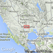
Pg. 1437-1455. Orinda formation. Assigned the Orinda to lower Pliocene and correlated it with Petaluma formation.
Source: US geologic names lexicon (USGS Bull. 896, p. 1560-1561).
For more information, please contact Nancy Stamm, Geologic Names Committee Secretary.
Asterisk (*) indicates published by U.S. Geological Survey authors.
"No current usage" (†) implies that a name has been abandoned or has fallen into disuse. Former usage and, if known, replacement name given in parentheses ( ).
Slash (/) indicates name conflicts with nomenclatural guidelines (CSN, 1933; ACSN, 1961, 1970; NACSN, 1983, 2005, 2021). May be explained within brackets ([ ]).