- Usage in publication:
-
- Orfordville formation
- Modifications:
-
- Principal reference
- Dominant lithology:
-
- Schist
- Quartzite
- AAPG geologic province:
-
- New England province
Summary:
Pg. 119-124, pl. 1 (geol. map); J.B. Hadley and others, 1938, Geol. map and structure sections of New Hampshire portion of Mt. Cube quadrangle, New Hampshire Hwy. Dept., scale 1:62,500; C.A. Chapman and others, 1938, Geol. map and structure sections of Mascoma quadrangle, New Hampshire, scale 1:62,500.
Orfordville formation. Black to dark-gray mica schist, quartz-mica schist, feldspathic quartzite, staurolite schist, and staurolite-kyanite schist in middle grade metamorphic zone. Ottrelite schist or black schistose graphitic quartzite locally; also lenses of fine-grained biotite gneiss of volcanic origin in upper part. Dark-gray slate in lower grade zone. Includes Post Pond volcanic member (new) at base, Hardy Hill quartzite member (new) near middle, and Sunday Mountain volcanic member (new) at top. Thickness about 5,000 feet. Underlies Albee formation. Age is Middle Ordovician(?).
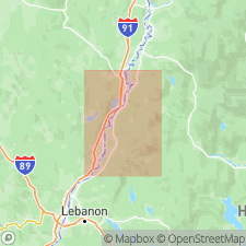
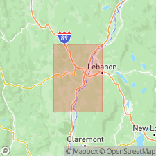
Type locality: Mt. Cube area, Grafton Co., western NH. Named from village of Orfordville near center of Mt. Cube 15-min quadrangle, Grafton Co., western NH. Crops out in belt trending southwestward from Orfordville in NH part of Mt. Cube quadrangle. Extends into VT.
Source: Publication; US geologic names lexicon (USGS Bull. 1200, p. 2850).

- Usage in publication:
-
- Orfordville formation
- Modifications:
-
- Revised
- AAPG geologic province:
-
- New England province
Summary:
Pg. 108 (fig. 2), 113-116, pl. 1 (geol. map). Orfordville formation. Stratigraphic revision. Includes (ascending) schists, Hardy Hill quartzite member (maximum 350 feet), schists, and Post Pond volcanic member (estimated 3,500 to 4,000 feet). Sunday Mountain volcanic member is considered equivalent of Post Pond member and is not separately mapped. [On p. 108 (fig. 2) age is considered Middle Ordovician(?); on pl. 1 (geol. map) age is considered Ordovician(?).]
Source: Publication; US geologic names lexicon (USGS Bull. 1200, p. 2850).

- Usage in publication:
-
- Orfordville Formation
- Modifications:
-
- Not used
- AAPG geologic province:
-
- New England province
Summary:
[In westernmost New Hampshire, in the central part of the Bronson Hill mantled gneiss domes, rocks previously assigned to Orfordville Formation are same as those included in (descending) Partridge Formation and Ammonoosuc Volcanics, which have priority.]
Source: Publication.

- Usage in publication:
-
- Orfordville Formation†
- Modifications:
-
- Abandoned
- AAPG geologic province:
-
- New England province
Summary:
Pg. 4. †Orfordville Formation of Hadley (1942) effectively abandoned by Thompson and others (1968, pl. 15-1a), who recognized that the Orfordville was largely or entirely = Ammonoosuc Volcanics. Spear and Rumble (1986) assigned the Post Pond Volcanic Member to the Ammonoosuc and the rusty schist to the Partridge Formation, whereas Moench (IGC field trip T162, Day 4, 1989) assigned the rusty schist to his Quimby Formation.
Source: Publication.
For more information, please contact Nancy Stamm, Geologic Names Committee Secretary.
Asterisk (*) indicates published by U.S. Geological Survey authors.
"No current usage" (†) implies that a name has been abandoned or has fallen into disuse. Former usage and, if known, replacement name given in parentheses ( ).
Slash (/) indicates name conflicts with nomenclatural guidelines (CSN, 1933; ACSN, 1961, 1970; NACSN, 1983, 2005, 2021). May be explained within brackets ([ ]).

