The National Geologic Map Database is migrating to a new infrastructure. We apologize for any service disruptions during this process.
|
|---|


- Usage in publication:
-
- Oreville Formation*
- Modifications:
-
- Named
- Dominant lithology:
-
- Schist
- AAPG geologic province:
-
- Midcontinent region
Summary:
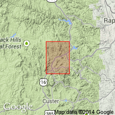
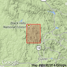
Named for Oreville rail siding in Custer quad 0.6 mi south of Hill City quadrangle on U.S. Hwy 16, Pennington Co, SD in Midcontinent region. Type locality is along north bank of Spring Creek west of Oreville where it has two pelitic facies: 1) biotite facies, a laminated quartz-biotite-garnet schist containing iron-stained garnet-rich beds a few tenths of an inch thick, locally grades into graphitic rocks; 2) muscovite facies, a streaked quartz-muscovite-biotite-garnet schist, thinly laminated to thick massive beds, and some without distinct bedding. Has abundant tiny magnetite octahedra and pyrite metacrysts or their hematite pseudomorphs. Along Zimmer Ridge, a psammite facies (massive to foliated) metagraywacke and quartz schist is named Zimmer Ridge Member of Oreville. Lower contact of formation not exposed; upper contact is a micaceous schist with metagraywacke of Bugtown Formation. Is probably 2,000 to 10,000 ft thick. Is of Precambrian age.
Source: GNU records (USGS DDS-6; Denver GNULEX).

- Usage in publication:
-
- Oreville Formation*
- Modifications:
-
- Age modified
- AAPG geologic province:
-
- Midcontinent region
Summary:
Mapped with Early Proterozoic units Xsh, Xms, Xgw, Xbs (Pl. 1) in central Black Hills, Custer Co, and Pennington Co, both in the Midcontinent region, SD. Geologic map.
Source: GNU records (USGS DDS-6; Denver GNULEX).
- Usage in publication:
-
- Oreville Formation*
- Modifications:
-
- Overview
- AAPG geologic province:
-
- Midcontinent region
Summary:
Represents a thick (about 3,000 m) eugeosynclinal sequence of meta-turbidites and associated rocks. Zimmer Ridge Member mapped at base. Is younger than Vanderlehr Formation. Nature of Vanderlehr-Oreville contact uncertain--could be gradational, or a fault, or an unconformity. Map area is in Midcontinent region. Of Early Proterozoic age.
Source: GNU records (USGS DDS-6; Denver GNULEX).
For more information, please contact Nancy Stamm, Geologic Names Committee Secretary.
Asterisk (*) indicates published by U.S. Geological Survey authors.
"No current usage" (†) implies that a name has been abandoned or has fallen into disuse. Former usage and, if known, replacement name given in parentheses ( ).
Slash (/) indicates name conflicts with nomenclatural guidelines (CSN, 1933; ACSN, 1961, 1970; NACSN, 1983, 2005, 2021). May be explained within brackets ([ ]).