The National Geologic Map Database is migrating to a new infrastructure. We apologize for any service disruptions during this process.
|
|---|


- Usage in publication:
-
- Oread limestone
- Modifications:
-
- Original reference
- AAPG geologic province:
-
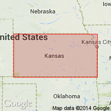
- Nemaha anticline
Summary:
Pg. 123, 124. Oread limestone. Very fossiliferous limestone, light-blue, weathering buff, 10 feet thick; capping all hills in vicinity of Lawrence, Kansas. Overlies Lawrence shales and underlies 8 feet of shale [Kanwaka shale member].
Named for fact it caps Mount Oread, at Lawrence, Douglas Co., KS.
Source: US geologic names lexicon (USGS Bull. 896, p. 1558).

- Usage in publication:
-
- Oread limestone member
- Modifications:
-
- Revised
- AAPG geologic province:
-
- Nemaha anticline
Summary:
Oread limestone member of Douglas formation. Includes (ascending) Weeping Water limestone, Snyderville shale, Leavenworth limestone, Heebner shale, and Plattsmouth limestone beds. Thickness 55 feet. Overlies Lawrence shale member of Douglas formation; underlies Kanwaka shale member of Shawnee formation. Age is Pennsylvanian (Missouri age). Report includes cross sections, measured sections, geologic maps, stratigraphic tables.
Source: GNC KS-NE Pennsylvanian Corr. Chart, sheet 1, Oct. 1936; supplemental information from GNU records (USGS DDS-6; Denver GNULEX).

- Usage in publication:
-
- Oread limestone
- Oread limestone member
- Modifications:
-
- Overview
- AAPG geologic province:
-
- Nemaha anticline
Summary:
Was for many years treated as top member of Douglas formation in Missouri. In Kansas the Douglas now treated as a group and the Oread as a formation. In Oklahoma the Oread limestone is treated as a member of Nelagoney formation. In Oklahoma thicknesses as high as 107 feet have been assigned to it.
Since 1931 the Kansas Geological Survey has included this limestone in Shawnee group, q.v. This change of definition has not been considered by the USGS for its publications [ca. 1938].
Source: US geologic names lexicon (USGS Bull. 896, p. 1558).
- Usage in publication:
-
- Oread formation
- Modifications:
-
- Overview
- AAPG geologic province:
-
- Nemaha anticline
Summary:
Pg. 2034-2036. Shawnee group was defined by Moore in 1932 (Kansas Geol. Soc. Gdbk., 6th Ann. Field Conf.) as extending from base of Oread formation to top of Topeka formation. This classification of the Shawnee is now recognized by interstate agreement. Oread formation comprises (ascending) Toronto limestone, Snyderville shale, Leavenworth limestone, Heebner shale, Plattsmouth limestone, Heumader shale, and Kereford limestone members. Overlies Lawrence formation; underlies Kanwaka formation.
See also F.C. Greene and W.V. Searight, 1949, Missouri Geol. Survey Rept. Inv., no. 11, p. vii (fig. 3), 16-17.
Source: US geologic names lexicon (USGS Bull. 1200, p. 2847).
- Usage in publication:
-
- Oread limestone
- Modifications:
-
- Revised
- AAPG geologic province:
-
- Nemaha anticline
Summary:
Pg. 26. Nebraska Geological Survey uses term Weeping Water limestone in preference to Toronto for basal member of Oread.
Source: US geologic names lexicon (USGS Bull. 1200, p. 2847).
- Usage in publication:
-
- Oread limestone member
- Modifications:
-
- Revised
- AAPG geologic province:
-
- Nemaha anticline
Summary:
Pg. 12 (fig. 1), 52-54, pl. 1. Member of Vamoosa formation in Oklahoma. At type locality, Oread is composed of four limestones and three shales. Leavenworth member (No. 2 limestone, counting from bottom) is Middle Oread of this report [Osage County]; Upper Oread is Plattsmouth member (No. 3 limestone). Basal limestone does not crop out in Oklahoma. Middle Oread is a thin limestone, decreasing from about 4 feet near Kansas line to about 4 inches in sec. 15, T. 26 N., R. 9 E. South of this point, it is a calcareous zone, approximately 15 feet above top of Upper Wyona sandstone and perhaps 30 feet below overlying Elgin sandstone. Near Kansas line where member is well developed, it lies between 15 and 90 feet below Upper Oread limestone and approximately 100 feet above top of Jonesburg sandstone.
Source: US geologic names lexicon (USGS Bull. 1200, p. 2847).

- Usage in publication:
-
- Oread limestone
- Modifications:
-
- Areal extent
- AAPG geologic province:
-
- Nemaha anticline
- Forest City basin
- Iowa shelf
Summary:
Pg. 21, fig. 5. Oread limestone. Basal formation in Shawnee group. Comprises (asending) Toronto limestone, Heebner shale, Plattsmouth limestone, Heumader shale, and Kereford limestone members. Kereford missing in some localities. Where Toronto is missing, base of formation is indeterminate, and Snyderville shale cannot be separated from underlying Douglas group. Thickness 42 to 52 feet. Age is Late Pennsylvanian (Virgilian).
Source: US geologic names lexicon (USGS Bull. 1200, p. 2847).

- Usage in publication:
-
- Oread Limestone
- Modifications:
-
- Overview
- AAPG geologic province:
-
- Nemaha anticline
Summary:
(Paleozoic Era; Pennsylvanian System by J.M Jewett, H.G. O'Connor, and D.E. Zeller, p. 35, 36.) Oread Limestone of Shawnee Group. The basal formation of the Shawnee Group comprises four limestone members and three shale members, which form a prominent escarpment across the State from Doniphan County, in the north, to Chautauqua County, in the south (fig. 1). The average thickness in northern and central Kansas outcrops is 52 feet. In southern outcrops the thickness increases to about 100 feet owing mainly to expansion of the interval between the lower two limestone members. Members are (ascending): Toronto Limestone Member, < 4 to 12 feet thick; Snyderville Shale Member, 12 to 75 feet thick; Leavenworth Limestone Member, 1 to 2 feet thick; Heebner Shale Member, 5 to 8 feet thick; Plattsmouth Limestone Member, 15 to 30 feet thick; Heumader Shale Member, 2 to 33 feet thick; Kereford Limestone Member, 0 to 40+ feet thick. Overlies Lawrence Formation; underlies Kanwaka Shale. Age is Late Pennsylvanian (Virgilian).
Source: Publication.
- Usage in publication:
-
- Oread Formation
- Modifications:
-
- Overview
- AAPG geologic province:
-
- Nemaha anticline
Summary:
Pg. 211. Oread Formation of Shawnee Group. T.L. Thompson (1995, Missouri Div. Geol. and Land Survey, v. 40 (2nd ser.) revised, p. 122-123) stated "The Oread Formation is composed an alternating succession of four limestone and three shale members...The complete succession is well-exposed at several places in Buchanan and Andrew counties [Missouri]. The total thickness of the Oread in Missouri is about 50 [feet]." The Oread Formation overlies the "upper unnamed shale member" of the Lawrence Formation, and underlies the Jackson Park Shale Member of the Kanwaka Formation. It comprises seven members. Members are (alphabetical): Heebner Shale Member, Heumader Shale Member, Kereford Limestone Member, Leavenworth Limestone Member, Plattsmouth Limestone Member, Snyderville Shale Member, and Toronto Limestone Member. Age is Late Pennsylvanian (Virgilian). Report includes nomenclature history.
Source: Publication.
For more information, please contact Nancy Stamm, Geologic Names Committee Secretary.
Asterisk (*) indicates published by U.S. Geological Survey authors.
"No current usage" (†) implies that a name has been abandoned or has fallen into disuse. Former usage and, if known, replacement name given in parentheses ( ).
Slash (/) indicates name conflicts with nomenclatural guidelines (CSN, 1933; ACSN, 1961, 1970; NACSN, 1983, 2005, 2021). May be explained within brackets ([ ]).