The National Geologic Map Database is migrating to a new infrastructure. We apologize for any service disruptions during this process.
|
|---|


- Usage in publication:
-
- Ordnance Plant member
- Modifications:
-
- Named
- Dominant lithology:
-
- Siltstone
- Shale
- AAPG geologic province:
-
- Chautauqua platform
- Arkoma basin
Summary:
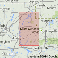
Name applied to the siltstone and shale facies of the Moorefield formation, basal formation of Mayes group (rank raised). Named for exposures (its type locality) along Pryor Creek within the Oklahoma Ordnance Plant and at west end of Low Water Dam in secs. 11 and 14, T 20 N, R 19 E, Mayes Co., OK on the Chautauqua platform. Mapped with other members of Moorefield on five geologic maps --1.) Vinita-Pensacola, 2.) Pryor-Salina, 3.) Hulbert-Parkhill, 4.) Tenkiller Ferry, and 5.) Stillwell areas; these maps cover all or parts of Craig, Mayes, Cherokee, Adair, Muskogee, and Sequoyah Cos., OK; these areas lie on the Chautauqua platform and in the Arkoma basin. Consists of a lower platy, blue and yellow siltstone 9 ft thick, a middle heavy bedded, blue, fine-grained dense, calcareous siltstone which weathers yellow, silty and into concentric elements 15 ft thick, and an upper brown to black, platy siltstone and shale 10 ft thick. Has maximum thickness of about 35 ft. Middle part not present to north. Overlies the newly named Lindsey Bridge member of Moorefield, and locally where Lindsey Bridge is missing, overlies the newly named Bayou Manard member of Moorefield. Unconformably overlain by Hindsville limestone. Sparingly fossiliferous (anthozoans, brachiopods, mollusks); fossils listed. Of [Late] Mississippian, Meramecian age. Measured sections.
Source: GNU records (USGS DDS-6; Denver GNULEX).
For more information, please contact Nancy Stamm, Geologic Names Committee Secretary.
Asterisk (*) indicates published by U.S. Geological Survey authors.
"No current usage" (†) implies that a name has been abandoned or has fallen into disuse. Former usage and, if known, replacement name given in parentheses ( ).
Slash (/) indicates name conflicts with nomenclatural guidelines (CSN, 1933; ACSN, 1961, 1970; NACSN, 1983, 2005, 2021). May be explained within brackets ([ ]).