- Usage in publication:
-
- Onate formation
- Modifications:
-
- Named
- Dominant lithology:
-
- Siltstone
- Limestone
- Shale
- Marl
- AAPG geologic province:
-
- Orogrande basin
Stevenson, F.V., 1945, Devonian of New Mexico: Journal of Geology, v. 53, no. 4, p. 217-245.
Summary:
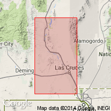
Named for Onate Mountain, San Andres Mountains north of San Andres Peak between San Andres Creek and Andrecito Creek, Dona Ana Co, NM, Orogrande basin. Type section is on north slope of San Andres Canyon near an abandoned mine in sec 18, T18S, R4E. Also used in the Sacramento Mountains. Unconformably overlies Silurian Fusselman limestone; the contact is concealed. Fusselman is a gray-brown siliceous limestone. Lowest exposed beds of Onate are gray to black, massive to thin-bedded, calcareous shales. Underlies Upper Devonian Sly Gap formation; upper contact is marl (Onate) beneath gray to black (rusty red- to black-weathering) massive siltstone (Sly Gap). Is limited in exposure to Sacramento Mountains, and southern and central portions of San Andres Mountains. Is 86 ft 4 in thick at type where it consists of: 1) siltstone that varies from buff, gray-brown, brown-black, massive to thin bedded; some nodular beds; some beds fossiliferous (crinoids, bryozoans); 2) gray-brown to black limestone; one bed is argillaceous, one bed has fossil bryozoans; 3) gray to black, calcareous, massive to thin-bedded shale; and 4) marl. Is a slope-former at most localities. Thins north of the type. Correlation chart. Cross section. Columnar section. Replaces name Canutillo formation in the Canutillo Mountains. Middle Devonian age.
Source: GNU records (USGS DDS-6; Denver GNULEX).

- Usage in publication:
-
- Onate Formation*
- Modifications:
-
- Overview
- Age modified
- AAPG geologic province:
-
- Orogrande basin
Summary:
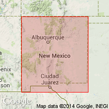
Type section is on south slope of Sheep Mountain, San Andres Mountains, Sierra Co., NM. Present in the northern Sacramento Mountains, Otero Co., in the San Andres Mountains, Sierra and Dona Ana Cos., in the southern Caballo and Mud Springs Mountains, Sierra Co., all in the Orogrande basin. Regionally may unconformably overlie several units --Montoya Group, Fusselman Dolomite --depending on locality. Underlies Sly Gap Formation, Onate-Sly Gap contact is regionally disconformable. Cross sections; correlation charts. Ranges between 85 to 95 ft thick. Thins north and south of the type. Fossils widely distributed in formation. Brachiopod assemblage represents 34 genera and 41 species (listed). Bryozoans common in upper part. Conodonts rare. A few tabulate corals, trace fossils, and the receptaculitid SPHAERO-SPONGIA. Age refined from Middle Devonian to late Middle Devonian, Taghanican, late Givetian. Is a shallow marine deposit. Trace fossils suggest extensive bioturbation.
Source: GNU records (USGS DDS-6; Denver GNULEX).
For more information, please contact Nancy Stamm, Geologic Names Committee Secretary.
Asterisk (*) indicates published by U.S. Geological Survey authors.
"No current usage" (†) implies that a name has been abandoned or has fallen into disuse. Former usage and, if known, replacement name given in parentheses ( ).
Slash (/) indicates name conflicts with nomenclatural guidelines (CSN, 1933; ACSN, 1961, 1970; NACSN, 1983, 2005, 2021). May be explained within brackets ([ ]).

