- Usage in publication:
-
- Omar sandstone lentil
- Modifications:
-
- First used
- Dominant lithology:
-
- Sandstone
- AAPG geologic province:
-
- Illinois basin
Summary:
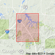
Term Wayside Member is restricted to the basal Caseyville strata below the Battery Rock Sandstone in south-central to southwestern IL. In the extreme southwestern portion of the quad a thick-bedded to massive cliff-forming sandstone, here referred to as the Omar sandstone lentil, occurs near the middle of the Wayside Member. A typical exposure of the Omar is found in NW1/4NE1/4/SW1/4, sec. 4 T12S, R2E. In the measured section of the Wayside in a north-trending ravine running through the center W1/2NE1/4, sec. 4, T12S, R2E, the Omar is 2-6 ft thick. Northward Omar is cut out and replaced by the Battery Rock Sandstone. The lentil, locally up to 40 ft thick, is composed of mature, fine-to coarse-grained, quartzose sandstone and ranges from thin to massive bedded. Contains scattered to locally abundant quartz pebbles.
Source: GNU records (USGS DDS-6; Reston GNULEX).
For more information, please contact Nancy Stamm, Geologic Names Committee Secretary.
Asterisk (*) indicates published by U.S. Geological Survey authors.
"No current usage" (†) implies that a name has been abandoned or has fallen into disuse. Former usage and, if known, replacement name given in parentheses ( ).
Slash (/) indicates name conflicts with nomenclatural guidelines (CSN, 1933; ACSN, 1961, 1970; NACSN, 1983, 2005, 2021). May be explained within brackets ([ ]).

