The National Geologic Map Database is migrating to a new infrastructure. We apologize for any service disruptions during this process.
|
|---|


- Usage in publication:
-
- Omar Formation
- Modifications:
-
- Original reference
- Dominant lithology:
-
- Sand
- Silt
- AAPG geologic province:
-
- Atlantic Coast basin
Summary:
Pg. 14 (fig. 2), 23 (fig. 3), 41-43, pl. 4. Omar Formation of Columbia Group. Name proposed for sediments that overlie Beaverdam Formation. Consists of interbedded gray to dark-gray quartz sands and silts. Individual beds range in thickness from a few inches to more than 10 feet. Thickness about 45 feet in type well. [Age is Pleistocene.]
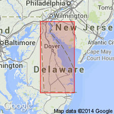
Type section (subsurface): DGS well Qh44-01 [near] junction of DE Route 26 and County Road 353 [Burbage Road], 2.5 mi east of Frankford, [UTM Zone 18, 483,348.6 m E., 4,264,827.0 m N.; approx. Lat. 38 deg. 31 min. 54.1 sec. N., Long. 75 deg. 11 min. 27.8 sec. W., Frankford 7.5-min quadrangle], Sussex Co., southern DE. Named from village of Omar, 2 mi east of Frankford.
[Additional locality information from Montana State Univ. Graphical Locator, USGS historical topographic map collection TopoView; accessed Independence Day, 2013.]
Source: US geologic names lexicon (USGS Bull. 1350, p. 541).
- Usage in publication:
-
- Omar Formation
- Modifications:
-
- Revised
- AAPG geologic province:
-
- Atlantic Coast basin
Summary:
Pg. 21. Beaverdam Formation considered a facies of Salisbury Formation (new) in this report. Omar Formation of Pleistocene age is in part the Beaverdam facies of this report. [Age is Pleistocene.]
Source: US geologic names lexicon (USGS Bull. 1350, p. 541).
- Usage in publication:
-
- Omar Formation*
- Modifications:
-
- Adopted
- AAPG geologic province:
-
- Atlantic Coast basin
Summary:
Omar Formation of Jordan (1962) accepted for use by the USGS. Unit overlies Beaverdam Sand and Chesapeake Group; underlies Ironshire Formation, Sinepuxent Formation, and Parsonsburg Sand. Onlapped by Kent Island Formation (new name). Age is Pleistocene (early Sangamonian).
Source: GNU records (USGS DDS-6; Reston GNULEX).
- Usage in publication:
-
- Omar Formation*
- Modifications:
-
- Revised
- AAPG geologic province:
-
- Atlantic Coast basin
Summary:
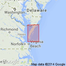
The Accomack beds of Mixon and others (1982), the dominantly transgressive sequence of sand, gravel, silt, clay, and peat that underlies the upland in the area north and west of the Ames Ridge shoreline in Accomack Co., VA, are here named the Accomack Member of the Omar Formation. Member is well developed from Wallops Station, VA, to Shelltown, MD. Informal facies A through G represent marginal marine depositional environments. Unconformably overlies the Tunnels Mill Member of the Yorktown Formation; disconformably underlies the Occohannock Member of the Nassawadox Formation. Thickness at type section northwest of Wattsville in northern part of Accomack Co. is 58 ft (18 m). Age is middle or late Pleistocene, based on paleomagnetic data, U/Th ages, and fossils.
Source: GNU records (USGS DDS-6; Reston GNULEX).
- Usage in publication:
-
- Omar Formation
- Modifications:
-
- Age modified
- Biostratigraphic dating
- AAPG geologic province:
-
- Atlantic Coast basin
Summary:
Omar Formation of Columbia Group in DE is described as a heterogeneous unit of fine to coarse sand, silty sand, clayey silt, and silty clay. Sands range from white to tan to bluish-gray; clays and silts range from brown to bluish-gray. Contains shell beds, unlike the underlying Beaverdam Formation. Unit consists of four lithofacies, the most distinct and thickest of which is bluish-gray, very fine sand interbedded with clayey silt and silty clay. This facies ranges from 10 to 80 ft thick and fills paleovalleys in the unconformably underlying Beaverdam. Pollen assemblages from the lower Omar indicate a Pliocene age and deposition in a lagoonal or estuarine environment. Pollen assemblages from the upper Omar indicate both cold and temperate climates and environments that range from bog to lagoon or estuary. Amino acid racemization analyses indicate approximate ages of 100,000, 200,000, and 500,000 yrs BP. Therefore, the upper Omar is Pleistocene.
Source: GNU records (USGS DDS-6; Reston GNULEX).
- Usage in publication:
-
- Omar Formation
- AAPG geologic province:
-
- Atlantic Coast basin
Ramsey, K.W., 2010, Stratigraphy, correlation, and depositional environments of the middle to late Pleistocene interglacial deposits of southern Delaware: Delaware Geological Survey Report of Investigations, no. 76, 43 p.
Summary:
Pg. 13+. Omar Formation of Assawoman Bay Group. [Not synopsized to date. See also Ramsey, K.W., 2010, Geol. map Georgetown quadrangle, Delaware Geol. Survey, Geol. Map Ser., no. 15, scale 1:24,000, and references therein.]
Source: NA
For more information, please contact Nancy Stamm, Geologic Names Committee Secretary.
Asterisk (*) indicates published by U.S. Geological Survey authors.
"No current usage" (†) implies that a name has been abandoned or has fallen into disuse. Former usage and, if known, replacement name given in parentheses ( ).
Slash (/) indicates name conflicts with nomenclatural guidelines (CSN, 1933; ACSN, 1961, 1970; NACSN, 1983, 2005, 2021). May be explained within brackets ([ ]).