

- Usage in publication:
-
- Olney limestone
- Modifications:
-
- Named
- Dominant lithology:
-
- Limestone
- AAPG geologic province:
-
- Appalachian basin
Summary:
Pg. 26, 27+. Olney limestone. Very largely fine interlaminated blue and drab layers, especially in lower 10 or 15 feet. Upper part often more coarsely bedded than lower part and frequently contains many stromatoporoids of dark color. It is often convenient to regard a zone of 1 to 3 feet as transitional into overlying water lime (Elmwood A). Base of Olney provisionally placed at sharp contact with a sun-cracked water lime which forms quarry floor at type locality. This subjacent water lime is thought to be below, or at least near lower limit of SPIRIFER VANUXEMI [brachiopod]; in central Onondaga County. Thickness of Olney 33+/- feet. Is basal formation of Manlius group in Onondaga County. May safely be regarded as included in Vanuxem's Manlius. It is also unquestionably represented in the 77 feet of strata which Hartnagel (1903, p. 1165) allows for the Manlius at type locality, but this latter thickness carries the Manlius of Hartnagel far below base of the Olney. Age is Silurian [see 1935 entry under Manlius Limestone; also for further details see p. 14-22 of book cited (New York State Mus. Bull., no. 300)].
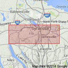
Type section: 1.75 mi east of Olney Station, at old quarry at Split Rock, formerly worked by Solvay Process Company. Named from Olney Station, on Auburn and Syracuse Electric RR, Onondaga Co., central NY.
Source: US geologic names lexicons (USGS Bull. 896, p. 1545; USGS Bull. 1200, p. 2356-2357).
For more information, please contact Nancy Stamm, Geologic Names Committee Secretary.
Asterisk (*) indicates published by U.S. Geological Survey authors.
"No current usage" (†) implies that a name has been abandoned or has fallen into disuse. Former usage and, if known, replacement name given in parentheses ( ).
Slash (/) indicates name conflicts with nomenclatural guidelines (CSN, 1933; ACSN, 1961, 1970; NACSN, 1983, 2005, 2021). May be explained within brackets ([ ]).