The National Geologic Map Database is migrating to a new infrastructure. We apologize for any service disruptions during this process.
|
|---|


- Usage in publication:
-
- Olema Creek Formation
- Modifications:
-
- Named
- Biostratigraphic dating
- Dominant lithology:
-
- Siltstone
- Claystone
- Gravel
- AAPG geologic province:
-
- California Coast Ranges province
Summary:
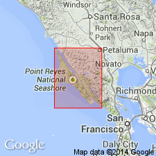
Type section designated as outcrop in Olema Creek between Boyd Stewart Ranch and Vedanta retreat, Marin Co, CA. Is confined to central part of San Andreas fault zone as shown on map of Point Reyes Peninsula. Consists of light-gray to brownish-gray clayey siltstone or claystone interbedded with coarse granitic gravel. Thickness is over 200 m; base is not exposed. Described as thin-bedded and laminated with abundant organic material and fresh water diatoms. Inferred to unconformably overlie serpentine and related Franciscan rocks of San Andreas fault zone. Underlies Quaternary sedimentary deposits. Is Pleistocene and Holocene age based on carbon-14 measurements on fossil wood of 38,700 +/-2000 yr B.P. and presence of Holocene diatom species.
Source: GNU records (USGS DDS-6; Menlo GNULEX).
For more information, please contact Nancy Stamm, Geologic Names Committee Secretary.
Asterisk (*) indicates published by U.S. Geological Survey authors.
"No current usage" (†) implies that a name has been abandoned or has fallen into disuse. Former usage and, if known, replacement name given in parentheses ( ).
Slash (/) indicates name conflicts with nomenclatural guidelines (CSN, 1933; ACSN, 1961, 1970; NACSN, 1983, 2005, 2021). May be explained within brackets ([ ]).