- Usage in publication:
-
- Old Maid Coulee Soil
- Modifications:
-
- Named
- Dominant lithology:
-
- Paleosol
- Loess
- Ash
- AAPG geologic province:
-
- Eastern Columbia basin
Summary:
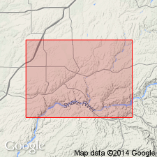
Named for Old Maid Coulee, [probably near town of Connell], in Cheney-Palouse Scabland Tract of the Channeled Scabland, Adams Co., southeastern WA. Type locality is a composite of six roadcuts recognized across 100 km transect here called "type transect". Strata previously assigned to [late Pleistocene] Palouse loess (informal). Described as weakly developed buried soil formed in upper part of loess layer over an unconformity marked by eroded and truncated paleosols. Elsewhere are scattered lenses of bedded basaltic sand and silt resembling flood-deposited slack-water sediments. Dominant feature is its cambic horizon with noticeably higher color value and chroma; carbonate is filamentous and disseminated, weak prismatic and subangular blocky structure. Late Pleistocene (>35,000 yr B.P.) Mount St. Helens set C tephra lies within or just below dominant cambic horizon; descending is structureless BC horizon containing small percentage of detrital and filamentous carbonate and marking base of the Old Maid Coulee. Maximum thickness is 2.5 m at KP-1 roadcut of "type transect". Unconformably overlies late Pleistocene Devils Canyon Soil (new). Unconformably underlies late Pleistocene Washtucna Soil (new). Age is late Pleistocene based on isotopic dating of wood and charcoal associated with deposits of Ape Canyon (set C) eruptive period of Mount St. Helens ranging from >35,000 to >42,000 yr B.P. (Crandell and others, 1981). Report includes stratigraphic column and correlation chart.
Source: GNU records (USGS DDS-6; Menlo GNULEX).
For more information, please contact Nancy Stamm, Geologic Names Committee Secretary.
Asterisk (*) indicates published by U.S. Geological Survey authors.
"No current usage" (†) implies that a name has been abandoned or has fallen into disuse. Former usage and, if known, replacement name given in parentheses ( ).
Slash (/) indicates name conflicts with nomenclatural guidelines (CSN, 1933; ACSN, 1961, 1970; NACSN, 1983, 2005, 2021). May be explained within brackets ([ ]).

