The National Geologic Map Database is migrating to a new infrastructure. We apologize for any service disruptions during this process.
|
|---|


- Usage in publication:
-
- Old Church Formation*
- Modifications:
-
- Named
- Dominant lithology:
-
- Sand
- AAPG geologic province:
-
- Atlantic Coast basin
Summary:
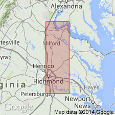
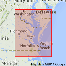
Old Church Formation at base of Chesapeake Group here named for small populated place approximately 6.8 km west-southwest of type section at Horseshoe, VA. Unit consists of grayish-olive, clayey and poorly sorted sand; very calcareous due to shell fragments as well as large numbers of Foraminifera and ostracodes. Large concretions in center of formation. Some glauconite present, probably reworked from underlying formation. Thickness about 3 ft. Correlates with Chickasawhayan beds of the River Bend Formation in NC. Included as "Zone 1" in the original definition of the Calvert Formation by Shattuck (1904). Outcrops from near Horseshoe to below the mouth of Matadequin Creek on the Pamunkey River in VA. Is subsurface elsewhere in VA and in MD. May be present in subsurface of DE and NJ. Unconformably overlies the Piney Point Formation and unconformably underlies the Calvert Formation. Age is here interpreted as late Oligocene and early Miocene.
Source: GNU records (USGS DDS-6; Reston GNULEX).
- Usage in publication:
-
- Old Church Formation*
- Modifications:
-
- Revised
- AAPG geologic province:
-
- Atlantic Coast basin
Summary:
Old Church Formation excluded from Chesapeake Group in this report, where Calvert Formation is considered the base of the Chesapeake. Unit is mapped, instead, with other lower Tertiary deposits.
Source: GNU records (USGS DDS-6; Reston GNULEX).
- Usage in publication:
-
- Old Church Formation*
- Modifications:
-
- Areal extent
- Biostratigraphic dating
- Age modified
- AAPG geologic province:
-
- Atlantic Coast basin
Summary:
Exmore corehole in outer Coastal Plain of VA (east of Chesapeake Bay) includes deposits equivalent to and younger than Old Church Formation (found on west side of Bay). Deposits consist of dark-olive-gray to greenish-black, glauconitic and phosphatic, fine to very coarse sand containing lesser amounts of quartz, in an olive-brown clay matrix. Section is noncalcareous except for top 10 ft which contain fairly abundant microfauna. In the core, sharp burrowed contact between upper Oligocene and lower Miocene(?) beds is probably an unconformity. Foraminifera data (C.W. Poag, written and oral commun., 1990), suggest that lower 17 ft of glauconitic and phosphatic sand is late early Oligocene and upper 23 ft is early Miocene. In contrast, dinocyst data (L.E. Edwards, written commun., 1988) indicate that same section is late Oligocene. Except for increase in calcareous content in upper 10 ft, section is lithically homogeneous and assigned tentatively to Old Church Formation. A date of late Oligocene and early Miocene is used in accompanying columnar section.
Source: GNU records (USGS DDS-6; Reston GNULEX).

- Usage in publication:
-
- Old Church Formation
- Modifications:
-
- Overview
- AAPG geologic province:
-
- Atlantic Coast basin
Summary:
Old Church Formation and unnamed glauconitic sands mapped together with Pamunkey Group on the State map as undifferentiated lower Tertiary deposits. Units are discussed separately in the text. Old Church, of the inner and middle Coastal plain, is 0 to 5 ft of olive gray, fine- to coarse-grained shelly, very sparsely glauconitic quartz sand. Contains ANOMIA RUFFINI, LUCINA sp., and MERCENARIA CAPAX. In subsurface of outer Coastal Plain, unit includes about 45 ft of dark-olive-gray to greenish-black glauconite sand with lesser amounts of quartz. Sand has olive-brown clay-silt matrix. Age is late Oligocene.
Source: GNU records (USGS DDS-6; Reston GNULEX).
- Usage in publication:
-
- Old Church(?) Formation
- Modifications:
-
- Overview
- AAPG geologic province:
-
- Atlantic Coast basin
Summary:
Occupies 5-ft interval from 23.5 ft to 18.5 ft in core-hole Ken-Bf 180, overlying the Paleocene Aquia Formation. Composed of clayey, glauconitic, fine to medium, quartz sand. Middle to late Oligocene foraminiferal assemblage found in the core sample at 19 ft. Assignment of strata to Old Church is tentative. [No mention of assignment to Chesapeake Group.] Underlies Miocene and Pliocene Pensauken Formation.
Source: GNU records (USGS DDS-6; Reston GNULEX).
For more information, please contact Nancy Stamm, Geologic Names Committee Secretary.
Asterisk (*) indicates published by U.S. Geological Survey authors.
"No current usage" (†) implies that a name has been abandoned or has fallen into disuse. Former usage and, if known, replacement name given in parentheses ( ).
Slash (/) indicates name conflicts with nomenclatural guidelines (CSN, 1933; ACSN, 1961, 1970; NACSN, 1983, 2005, 2021). May be explained within brackets ([ ]).