- Usage in publication:
-
- Old Bridge sand member*
- Modifications:
-
- Named
- Dominant lithology:
-
- Sand
- Clay
- AAPG geologic province:
-
- Atlantic Coast basin
Summary:
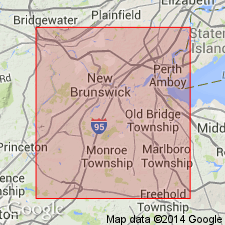
Old Bridge sand member of Raritan formation named in Middlesex Co., NJ. Commonly a fine- to medium-grained sand, locally quite coarse; cross-bedded, slightly micaceous; occasional small beds of clay. At outcrop, practically free of pyrite and lignite, but samples from boreholes show that downdip these substances are fairly common; dry sand is white or yellow. Thickness 80 to 110 ft (data based on surface exposures and from wells). Unit is No. 3 sand of previous reports. Occurs near top of formation below Amboy stoneware clay and above South Amboy fire clay, both of which are considered informal economic terms. Separated from Sayreville sand member (new) by South Amboy fire clay. Most of discussion of unit deals with its relationship to ground-water supply.
Source: GNU records (USGS DDS-6; Reston GNULEX).

- Usage in publication:
-
- Old Bridge Sand Member*
- Modifications:
-
- Revised
- AAPG geologic province:
-
- Atlantic Coast basin
Summary:
Old Bridge Sand Member removed from Raritan Formation and made basal member of Magothy Formation.
Source: GNU records (USGS DDS-6; Reston GNULEX).
For more information, please contact Nancy Stamm, Geologic Names Committee Secretary.
Asterisk (*) indicates published by U.S. Geological Survey authors.
"No current usage" (†) implies that a name has been abandoned or has fallen into disuse. Former usage and, if known, replacement name given in parentheses ( ).
Slash (/) indicates name conflicts with nomenclatural guidelines (CSN, 1933; ACSN, 1961, 1970; NACSN, 1983, 2005, 2021). May be explained within brackets ([ ]).

