- Usage in publication:
-
- Ola Formation*
- Modifications:
-
- Named
- Dominant lithology:
-
- Schist
- Gneiss
- AAPG geologic province:
-
- Piedmont-Blue Ridge province
Summary:
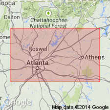
The Ola Formation of the Great Smoky Group is here named for outcrops in the Ola quadrangle, Henry Co., GA. It is the lower unit, underlying and infolded with the Kalves Creek Formation, in the Ola anticlinorium of the Bill Arp thrust sheet. It consists of medium- to coarse-grained schists with lenses of biotite-plagioclase gneiss (metagraywacke or metasiltstone). Age is Late Proterozoic.
Source: GNU records (USGS DDS-6; Reston GNULEX).

- Usage in publication:
-
- Ola Formation†
- Modifications:
-
- Abandoned
- AAPG geologic province:
-
- Piedmont-Blue Ridge province
Summary:
Detailed mapping of Ola Formation in its type area and east of Athens 1:100,000 quad, as well as study of thin sections, has shown that most of the schist of the Ola is actually schistose biotite gneiss of the Stonewall Gneiss. Therefore, Ola Formation is abandoned herein and its rocks reassigned to Stonewall Gneiss. Report includes geologic map and correlation chart.
Source: GNU records (USGS DDS-6; Reston GNULEX).
For more information, please contact Nancy Stamm, Geologic Names Committee Secretary.
Asterisk (*) indicates published by U.S. Geological Survey authors.
"No current usage" (†) implies that a name has been abandoned or has fallen into disuse. Former usage and, if known, replacement name given in parentheses ( ).
Slash (/) indicates name conflicts with nomenclatural guidelines (CSN, 1933; ACSN, 1961, 1970; NACSN, 1983, 2005, 2021). May be explained within brackets ([ ]).

