The National Geologic Map Database is migrating to a new infrastructure. We apologize for any service disruptions during this process.
|
|---|


- Usage in publication:
-
- Okmok ash*
- Modifications:
-
- Named
- Dominant lithology:
-
- Ash
- Volcaniclastics
- Volcanics
- AAPG geologic province:
-
- Aleutian Islands province
- Alaska Southwestern region
Summary:
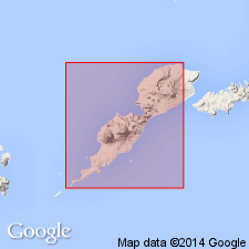
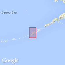
[Named for Okmok Volcano in east-central part of Umnak 1:250,000 quad, Aleutian Islands, AK.] [no type designated] Occurs in caldera walls and on slopes of Okmok Volcano. Consists chiefly of 1- to 10-ft-thick beds of well-sorted ash, lapilli, fragments of accessory materials, agglomerate, and minor interbedded lava flows (20 to 50 feet thick), and tuff-breccia beds. Thickness in caldera walls is more than 300 feet, averages 170 feet and on outer volcano slopes decreases to less than 5 feet along sea coast. [Unconformably?] overlies, locally, Tanak volcanics. Age is given as Quaternary [based on regional relations].
Source: GNU records (USGS DDS-6; Menlo GNULEX).
- Usage in publication:
-
- Okmok volcanics*
- Modifications:
-
- Redescribed
- Revised
- AAPG geologic province:
-
- Aleutian Islands province
- Alaska Southwestern region
Summary:
Okmok ash (Byers, 1947) is redescribed as Okmok volcanics and stratigraphically extended to include herein abandoned Tanak volcanics. Type locality designated as "on north rim of Okmok Caldera"; measured section at type locality (53 deg 28.2'N, 168 deg 08.1'E) has total thickness of 410 ft. [Unconformably?] overlies Crater Creek basalt. Age is given as early Holocene [based on regional geologic relations and physiographic evidence].
Source: GNU records (USGS DDS-6; Menlo GNULEX).
For more information, please contact Nancy Stamm, Geologic Names Committee Secretary.
Asterisk (*) indicates published by U.S. Geological Survey authors.
"No current usage" (†) implies that a name has been abandoned or has fallen into disuse. Former usage and, if known, replacement name given in parentheses ( ).
Slash (/) indicates name conflicts with nomenclatural guidelines (CSN, 1933; ACSN, 1961, 1970; NACSN, 1983, 2005, 2021). May be explained within brackets ([ ]).