

- Usage in publication:
-
- Okapilco Member
- Modifications:
-
- First used
- Dominant lithology:
-
- Limestone
- AAPG geologic province:
-
- South Georgia sedimentary province
Summary:
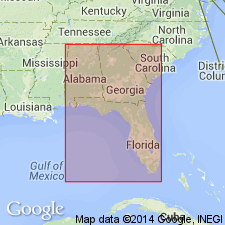
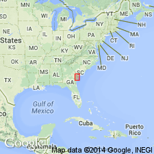
Name Okapilco Member of Suwannee Limestone credited to Huddlestun (in press). Name appears in several figures. In Alum Bluff 1 core (W-6901, Florida Geological Survey), Liberty Co., FL, unit occupies interval between 287 ft and 357 ft. Overlies Wolf Pit Dolomite (first used).
Source: GNU records (USGS DDS-6; Reston GNULEX).
- Usage in publication:
-
- Okapilco Limestone
- Modifications:
-
- Named
- Dominant lithology:
-
- Limestone
- AAPG geologic province:
-
- South Georgia sedimentary province
Summary:
Name Okapilco Limestone is proposed in this report for a distinctive calcarenitic, colonial coral-bearing limestone at the top of the Oligocene section within and on the western flank of the Gulf Trough in GA. The limestone previously has been referred to the Suwannee Limestone and the Byram Formation. Type section is designated in Colquitt Co., GA, where unit is 210 ft (64 m) thick and reference sections are designated at the site of the core Coffee 4 (GGS-3541), approximately 1.7 mi northeast of the community of Pridgen in northern Coffee Co., and at the core site of the Berrien 10, 2.1 mi northeast of the village of Enigma in northwestern Berrien Co., GA. The Okapilco consists of massive and structureless, sporadically dolomitized limestone that is varyingly indurated and recrystallized, sporadically chalky, and moderate to coarsely but irregularly granular. Contains abundant colonial corals or coral heads, scattered molds of mollusks, some larger Foraminifera, and rare Bryozoa. Locally pyritic. Characterized by its uneven or irregular bioclastic texture. Unit occurs from the vicinity of Coffee Co. in the northeast to at least central Colquitt Co. in the southwest. Though areal limits are unknown, it has not been identified in Grady Co., GA, or Gadsden Co., FL. [Though Okapilco is shown in the Alum Bluff core by Bryan (1993), that interval in this report is unnamed.] Okapilco disconformably overlies the Wolf Pit Dolostone (new) and unconformably underlies the Miocene Parachucla Formation of the Hawthorne Group. Correlated with the Bucatunna Clay of MS, AL, and western FL on the basis of planktonic foraminifers. Age is early Oligocene (latest Vicksburgian, Rupelian).
Source: GNU records (USGS DDS-6; Reston GNULEX).
For more information, please contact Nancy Stamm, Geologic Names Committee Secretary.
Asterisk (*) indicates published by U.S. Geological Survey authors.
"No current usage" (†) implies that a name has been abandoned or has fallen into disuse. Former usage and, if known, replacement name given in parentheses ( ).
Slash (/) indicates name conflicts with nomenclatural guidelines (CSN, 1933; ACSN, 1961, 1970; NACSN, 1983, 2005, 2021). May be explained within brackets ([ ]).