

- Usage in publication:
-
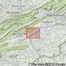
- Oglesby marble member
- Modifications:
-
- Named
- Dominant lithology:
-
- Limestone
- AAPG geologic province:
-
- Appalachian basin
Summary:
Named the Oglesby marble member of the Nittany formation for Oglesby School near Pulaski-Wythe Cos. line, southwestern VA. Consists of very fine-grained, pinkish- and bluish-gray, vaughanitic limestone. Thickness at type locality is 90 to 115 feet. Overlies chert, dolomite, and limestone of Nittany. The Oglesby is of Early Ordovician age.
Source: GNU records (USGS DDS-6; Reston GNULEX).
For more information, please contact Nancy Stamm, Geologic Names Committee Secretary.
Asterisk (*) indicates published by U.S. Geological Survey authors.
"No current usage" (†) implies that a name has been abandoned or has fallen into disuse. Former usage and, if known, replacement name given in parentheses ( ).
Slash (/) indicates name conflicts with nomenclatural guidelines (CSN, 1933; ACSN, 1961, 1970; NACSN, 1983, 2005, 2021). May be explained within brackets ([ ]).