


- Usage in publication:
-
- Odenville limestone*
- Modifications:
-
- Named
- Dominant lithology:
-
- Limestone
- AAPG geologic province:
-
- Appalachian basin
Summary:
Odenville limestone (new name) consists of impure argillaceous and siliceous dark fine-grained cherty limestone, 50+/-ft thick. Overlies Newala limestone and unconformably underlies Mosheim limestone. Only known exposure is in a cut or borrow pit on north side of Seaboard Air Line Railway, Just east of Odenville, St. Clair Co., AL. Contains Beekmantown fossils, therefore age is Early Ordovician.
Source: GNU records (USGS DDS-6; Reston GNULEX).
- Usage in publication:
-
- Odenville Limestone
- Modifications:
-
- Reinstated
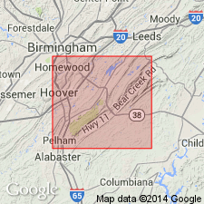
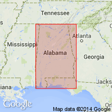
- Areal extent
- Overview
- AAPG geologic province:
-
- Appalachian basin
Summary:
Though the Odenville was abandoned as a stratigraphic unit by the Alabama Geological Survey (Raymond and others, 1988), it is proven in this report that the Odenville is a valid, mappable stratigraphic unit and author returns formal status to the unit as the uppermost formation of the Knox Group. As described by Roberson (1988: U. of AL M.S. thesis), the Odenville includes a thin lower unit dominated by mottled dolomitic limestone and an upper unit composed of stylonodular fossiliferous limestone. Limestone in the lower unit is medium dark gray to dark gray, thick bedded to massive, micritic, and contains abundant irregular mottled areas composed of light-greenish-gray finely crystalline dolomite and dolomitic limestone. Contact between the underlying Newala and the Odenville is gradational. The contact is placed at the top of the highest interbedded dolomite in the transitional sequence. Bedded dolomite is excluded from the lower Odenville. The lower part of the Odenville grades upward into the dark-gray thick-bedded fossiliferous dolomitic limestone characterized by well-developed stylonodular laminae of the upper part. Contains dark-gray to black chert nodules which are useful in mapping the distribution of the unit. Uppermost part of the Odenville is very dolomitic. As the type section is no longer exposed, reference sections are here proposed. The best natural exposures of the Odenville are along Shephard Branch on the southeast side of AL Hwy 119 in Jefferson Co. (SW1/4SW1/4 sec. 11, T18S, R1W), where the unit is approximately 267 ft though lower contact is not exposed. Odenville is also well exposed where Lee Branch enters Lake Purdy (NW1/4NW1/4 sec. 28, T128S, R1W). As presently defined, the Odenville extends throughout the Cahaba Valley from somewhere between Odenville and Fremont Gap in St. Clair Co. southwestward to the Coastal Plain overlap in Chilton Co. Thickness of the unit is variable --thickest in the Lake Purdy area and thinning both to the southwest and northeast. 366 ft measured at the Lee Branch; 50 ft estimated at Odenville. According to Roberson (1988), the Odenville contains a distinctive stenohaline fauna that is more diverse and abundant than the fauna of the underlying units of the Knox Group. The stenohaline fauna is dominated by lithistid sponges, brachiopods, cephalopods, and gastropods. Available biostratigraphic data indicate a very latest Canadian (latest Early Ordovician) age for the bulk of the Odenville. The uppermost beds may be as young as earliest Whiterockian (earliest Middle Ordovician).
Source: GNU records (USGS DDS-6; Reston GNULEX).
- Usage in publication:
-
- Odenville Limestone
- Modifications:
-
- Revised
- AAPG geologic province:
-
- Appalachian basin
Summary:
Odenville Limestone is assigned to the top of the Knox Group in the Helena thrust sheet of AL. On recent geologic maps, these rocks had been included in the underlying Newala, but recent work indicates that the Odenville is lithologically distinct and mappable (see Osborne, in press: AL G.S. Bull. 144). According to Roberson (1988: MS thesis), the Odenville includes a thin lower unit dominated by burrow-mottled dolomitic limestone and a thicker upper unit consisting of stylonodular fossiliferous limestone. Upper unit locally contains small irregular chert nodules, many of which are silicified sponges. Unit contains a stenohaline fauna that includes lithistid sponges, brachiopods, cephalopods, gastropods and trilobites. Reaches a maximum thickness of 366 ft. In the area between the Helena fault and the Rock Creek School fault in Bibb Co., the Odenville is absent and Middle Ordovician rocks lie directly on the Newala.
Source: GNU records (USGS DDS-6; Reston GNULEX).
For more information, please contact Nancy Stamm, Geologic Names Committee Secretary.
Asterisk (*) indicates published by U.S. Geological Survey authors.
"No current usage" (†) implies that a name has been abandoned or has fallen into disuse. Former usage and, if known, replacement name given in parentheses ( ).
Slash (/) indicates name conflicts with nomenclatural guidelines (CSN, 1933; ACSN, 1961, 1970; NACSN, 1983, 2005, 2021). May be explained within brackets ([ ]).