- Usage in publication:
-
- Odell shale member
- Modifications:
-
- Original reference
- Dominant lithology:
-
- Shale
- AAPG geologic province:
-
- Nemaha anticline
Summary:
Odell shale. Basal member of Enterprise [shale] of Sumner group, limited by Krider limestone above and by either Cresswell limestone or transitional top of Luta limestone below [see under Cresswell limestone], and generally consisting of 3 zones, as follows (descending): (1) olive-drab to buff shale, with top 1 foot becoming quite calcareous, somewhat fossiliferous, and transitional to Krider limestone, 3.5 feet; (2) chocolate-maroon shales, distinctive because of banded appearance due to presence of thin persistent seams of bright olive and light-greenish argillaceous shale, 18 feet; (3) olive-drab to gray argillaceous massive shales with some calcareous content, geodal, and some chalcedony concretions, 8 feet or more. Thickness of Odell shale, 30+/- feet in Nebraska and 37 or 38 feet in vicinity of Arkansas City, southern Kansas. Age is Permian (Big Blue).
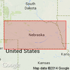
Type locality: exposures in ravines and highway cuts 1/8 mi south and 2.25 mi east of Odell, in southwestern Gage Co., southeastern NE. Named from town of Odell.
Source: US geologic names lexicon (USGS Bull. 896, p. 1530); GNC KS-NE Permian Corr. Chart, Oct. 1936; supplemental information from GNU records (USGS DDS-6; Denver GNULEX).
For more information, please contact Nancy Stamm, Geologic Names Committee Secretary.
Asterisk (*) indicates published by U.S. Geological Survey authors.
"No current usage" (†) implies that a name has been abandoned or has fallen into disuse. Former usage and, if known, replacement name given in parentheses ( ).
Slash (/) indicates name conflicts with nomenclatural guidelines (CSN, 1933; ACSN, 1961, 1970; NACSN, 1983, 2005, 2021). May be explained within brackets ([ ]).

