

- Usage in publication:
-
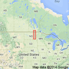
- Odanah Member*
- Modifications:
-
- Biostratigraphic dating
- Reference
- Dominant lithology:
-
- Shale
- AAPG geologic province:
-
- Williston basin
Summary:
Assigned as a member of Pierre Shale in eastern ND in Williston basin. No type locality designated. Named Odanah Beds in Manitoba and treated as a member of Riding Mountain Formation. In Pembina Mountain area of northeastern ND, the soft DeGrey Member of Pierre is overlain conformably by hard, light-gray siliceous shale that contains ferruginous concretions. This hard shale is obviously the southward continuation of Odanah Beds [of Manitoba]. A partial thickness of 65 ft described in a reference section of Pierre Shale (Pembina Mountain section), measured in sec 24, T161N, R57W, Cavalier Co, ND. A cursory examination of logs of oil and gas wells in northern ND suggest that the member may reach a thickness of about 200 ft in eastern Rolette Co, ND, from where it appears to thin abruptly to west. On South Branch of Park River in northern Walsh Co, 10-100 ft of dark, fissile shale that weathers to a sticky black clay overlies beds interpreted as Odanah. These [unnamed] shales may be equivalent to upper part of Virgin Creek Member of Pierre [in Missouri River Valley, SD]. Lists fossils. Probably equivalent to Verendrye and lower part of Virgin Creek Member of Pierre in Missouri Valley, SD. May correlate with middle and upper part of Bearpaw Shale in central MT, and with Kara Bentonitic Member and most of upper half of underlying unnamed shale member of Pierre in southwestern Black Hills region [eastern WY]. Late Cretaceous (Campanian) age.
Source: GNU records (USGS DDS-6; Denver GNULEX).
For more information, please contact Nancy Stamm, Geologic Names Committee Secretary.
Asterisk (*) indicates published by U.S. Geological Survey authors.
"No current usage" (†) implies that a name has been abandoned or has fallen into disuse. Former usage and, if known, replacement name given in parentheses ( ).
Slash (/) indicates name conflicts with nomenclatural guidelines (CSN, 1933; ACSN, 1961, 1970; NACSN, 1983, 2005, 2021). May be explained within brackets ([ ]).