The National Geologic Map Database is migrating to a new infrastructure. We apologize for any service disruptions during this process.
|
|---|


- Usage in publication:
-
- Ochoa series
- Modifications:
-
- First used
- AAPG geologic province:
-
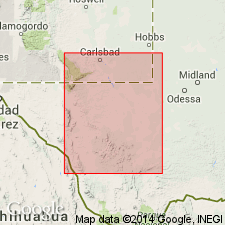
- Permian basin
Summary:
The authors advocate classification of American Permian as a system composed of 4 sedimentary divisions of series rank, based on section exposed adjacent to Delaware basin of west TX and southeastern NM in Permian basin. Divisions are (ascending): Wolfcamp, Leonard, Guadalupe, and Ochoa series [all first used as series terms]. Ochoa series named for Ochoa Post Office in T24S, R34E, Lea Co, NM in Permian basin, where a subsurface type section designated. Ochoa series includes all Upper Permian sediments of post-Guadalupe age, and consists largely of evaporites, attaining a subsurface thickness of much more than 4,000 ft. 4 distinct subdivisions recognized: Lower Castile, Upper Castile, Rustler, and Dewey Lake. Lower Castile confined to Delaware basin, where it rests on Delaware Mountain sandstone. Basal conglomerate present locally. Outcrops of Ochoa-age beds in Eddy Co, NM and Culberson CO, TX, but these are not representative of the type sequence. Outside Delaware basin Upper Castile overlaps onto and rests conformably on Guadalupe-age beds. Only a few pelecypods found in Rustler; rest of series appears unfossiliferous. Ochoa-age outcrops are not recognized by the authors along eastern margin of Permian basin in TX or TX Panhandle, and appear to be absent in OK, KS, and NE. Beyond the limits of Delaware basin seem to pinch out eastward and northward in the subsurface before reaching outcrops.
Source: GNU records (USGS DDS-6; Denver GNULEX).
For more information, please contact Nancy Stamm, Geologic Names Committee Secretary.
Asterisk (*) indicates published by U.S. Geological Survey authors.
"No current usage" (†) implies that a name has been abandoned or has fallen into disuse. Former usage and, if known, replacement name given in parentheses ( ).
Slash (/) indicates name conflicts with nomenclatural guidelines (CSN, 1933; ACSN, 1961, 1970; NACSN, 1983, 2005, 2021). May be explained within brackets ([ ]).