The National Geologic Map Database is migrating to a new infrastructure. We apologize for any service disruptions during this process.
|
|---|


- Usage in publication:
-
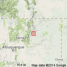
- Ocate sandstone*
- Modifications:
-
- Named
- Dominant lithology:
-
- Sandstone
- AAPG geologic province:
-
- Las Vegas-Raton basin
- Sierra Grande uplift
Summary:
Named for exposures on Ocate Creek about 1 1/2 mi east of Ocate, Mora Co, NM, Las Vegas-Raton basin. No type locality designated. Is mappable southward for at least 35 mi and is present northward to CO-NM State line. Present on Turkey Mountain, Mora Co, and in canyon of Canadian River, Harding Co, NM, Sierra Grande uplift. Consists of gray, medium to massive, somewhat cross-laminated sandstone about 50 ft thick. Is usually medium-size, well-rounded quartz grains with frosted surfaces. Ferruginous stains and calcite veins common. Overlies Naranjo formation conformably. Underlies Wanakah formation conformably. Probably correlates with Entrada sandstone of western NM and Exeter sandstone of northeast NM and northwest OK. Assigned a Jurassic age.
Source: GNU records (USGS DDS-6; Denver GNULEX).
- Usage in publication:
-
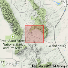
- Ocate sandstone†
- Modifications:
-
- Abandoned
Summary:
Sandstone called Entrada sandstone in this report east of the Rocky Mountains in Huerfano and Custer Cos, CO, Las Vegas-Raton basin is believed to be equivalent to the Entrada to the west. Is also identical to rocks to south in Mora Co, NM called Ocate sandstone and to southeast along the Dry Cimarron, Union Co, NM called Exeter sandstone. Names Ocate and Exeter abandoned. Name Entrada used throughout area.
Source: GNU records (USGS DDS-6; Denver GNULEX).
For more information, please contact Nancy Stamm, Geologic Names Committee Secretary.
Asterisk (*) indicates published by U.S. Geological Survey authors.
"No current usage" (†) implies that a name has been abandoned or has fallen into disuse. Former usage and, if known, replacement name given in parentheses ( ).
Slash (/) indicates name conflicts with nomenclatural guidelines (CSN, 1933; ACSN, 1961, 1970; NACSN, 1983, 2005, 2021). May be explained within brackets ([ ]).