

- Usage in publication:
-
- Oak Hill member
- Modifications:
-
- Named
- Dominant lithology:
-
- Clay
- Silt
- Sand
- AAPG geologic province:
-
- Mid-Gulf Coast basin
Summary:
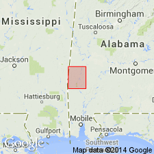
Oak Hill member of Naheola formation, introduced by Toulmin (1944: AL Acad Sci, Journal, v. 16, p. 42), is described in this report as predominantly gray laminated carbonaceous clay, sandy clay, and micaceous silt, alternating with cross-bedded sand. Locally, sandy clay is thin bedded. At some localities member contains massive beds of very fine grained micaceous sand, generally silty or clayey enough to be compact and tough; laminated sand and shale, at top, contains one or more lignite beds as much as 5 ft thick. Thickness of Oak Hill member is 100 to 125 ft. Unconformably underlies Coal Bluff member; overlies Mathews Landing marl member of Porters Creek formation. Age is Paleocene.
Source: GNU records (USGS DDS-6; Reston GNULEX).
- Usage in publication:
-
- Oakhill member
- Modifications:
-
- Areal extent
- AAPG geologic province:
-
- Mid-Gulf Coast basin
Summary:
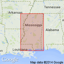
Naheola formation in west-central AL and MS comprises (ascending) Matthews Landing, Oakhill [Oak Hill], and Kemper (new) members.
Source: GNU records (USGS DDS-6; Reston GNULEX).

- Usage in publication:
-
- Oak Hill Member
- Modifications:
-
- Overview
- AAPG geologic province:
-
- Mid-Gulf Coast basin
Summary:
Oak Hill Member, lower unit of Naheola Formation (Midway Group), is AL State usage. Unit consists of brownish-gray laminated sandy silt and silty clay and beds of greenish-gray fine-grained sand. Lignite, 1 to 7 ft thick, is present locally at the top of the Oak Hill. Unit is generally 80 to 250 ft thick in the western Coastal Plain but thins greatly east of Wilcox Co., and is absent east of Butler Co. It thickens west of Wilcox Co. and becomes more sandy in MS. Underlies Coal Bluff Marl Member of the Naheola and overlies Matthews Landing Marl Member of the Porters Creek Formation. Age is Paleocene (Midwayan--early Thanetian).
Source: GNU records (USGS DDS-6; Reston GNULEX).
For more information, please contact Nancy Stamm, Geologic Names Committee Secretary.
Asterisk (*) indicates published by U.S. Geological Survey authors.
"No current usage" (†) implies that a name has been abandoned or has fallen into disuse. Former usage and, if known, replacement name given in parentheses ( ).
Slash (/) indicates name conflicts with nomenclatural guidelines (CSN, 1933; ACSN, 1961, 1970; NACSN, 1983, 2005, 2021). May be explained within brackets ([ ]).