


- Usage in publication:
-
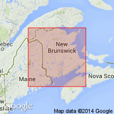
- Oak Bay formation
- Modifications:
-
- Named
- Dominant lithology:
-
- Conglomerate
Summary:
Named Oak Bay formation in New Brunswick, Canada for Village of Oak Bay. Unit is exposed on Rodger's Island in Oak Bay and to northeast and southwest on mainland. The Oak Bay consists of conglomerate with some granite pebbles. Formation unconformably overlies the Dennis and Waweig formations. It is considered of Devonian age.
Source: GNU records (USGS DDS-6; Reston GNULEX).
- Usage in publication:
-
- Oak Bay formation
- Modifications:
-
- Age modified
Summary:
The Oak Bay formation is the lowest formation of the Silurian succession of the Mascarene group in New Brunswick, Canada. Unit is composed of conglomerate with some arkose and serves to differentiate the Silurian from the pre-Silurian rocks.
Source: GNU records (USGS DDS-6; Reston GNULEX).
- Usage in publication:
-
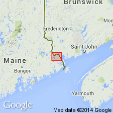
- Oak Bay Formation
- Modifications:
-
- Areal extent
- AAPG geologic province:
-
- New England province
Summary:
Geographically extended the Oak Bay formation of New Brunswick, Canada to Maine. Unit is exposed along St. Croix River, southeast of Calais, ME. Near Calais, the Oak Bay is a steeply dipping metamorphosed conglomerate composed of well-rounded pebbles and cobbles in a schistose matrix and is 320 to 1300 feet thick. It overlies dark argillite division of the Charlotte Group and is considered of Middle Silurian age.
Source: GNU records (USGS DDS-6; Reston GNULEX).
- Usage in publication:
-
- Oak Bay Conglomerate
- Modifications:
-
- Age modified
- AAPG geologic province:
-
- New England province
Summary:
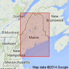
Age of Oak Bay changed from Middle Silurian to Early Silurian (late Llandovery) in Oak Bay area and far eastern Maine.
Source: GNU records (USGS DDS-6; Reston GNULEX).

- Usage in publication:
-
- Oak Bay Formation
- Modifications:
-
- Overview
- AAPG geologic province:
-
- New England province
Summary:
Exposure of the conglomerates of the Oak Bay Formation is continuous along the west shore of Cookson Island where unit reaches its greatest thickness (300 m). Forms a broad lens, which thins to the northeast and southwest. Above the basal zone, conglomerate is massive, but with subtle gradational changes in clast size. Amount of matrix varies; generally clast supported. Deposition was apparently continuing and uninterrupted. Clasts are well-rounded to subrounded, predominantly volcanic and range through the pebble-cobble-boulder scale. Clasts average 4-8 cm, scattered boulders in lower one third of formation range to 30 cm. Matrix consists poorly sorted pebbles, grit, and sand. Unconformably overlies Cookson Formation and conformably underlies Waweig Formation. Age probably Ludlow to Pridoli, based on its position below the Waweig.
Source: GNU records (USGS DDS-6; Reston GNULEX).
For more information, please contact Nancy Stamm, Geologic Names Committee Secretary.
Asterisk (*) indicates published by U.S. Geological Survey authors.
"No current usage" (†) implies that a name has been abandoned or has fallen into disuse. Former usage and, if known, replacement name given in parentheses ( ).
Slash (/) indicates name conflicts with nomenclatural guidelines (CSN, 1933; ACSN, 1961, 1970; NACSN, 1983, 2005, 2021). May be explained within brackets ([ ]).