

- Usage in publication:
-
- Nuuanu volcanics*
- Modifications:
-
- Named
- Dominant lithology:
-
- Volcanics
- AAPG geologic province:
-
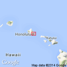
- Oahu
Summary:
Named for Nuuanu Valley in which it occurs. Exposed for about 2 sq mi in valley behind and in city of Honolulu [Honolulu 7.5' quad] Island of Oahu. Included as unit in lower part of Honolulu volcanic series. Divided into upper flow exposed along Kamehameha Hwy and lower flow which extends from near Lower Luakaha to the sea. Composed of lava flows of melilite-nepheline basalt and nepheline basalt, associated cinder cones, and palagonitized tuff. Lowest flow overlies weathered alluvium on Koolau volcanic series (new). Assigned to Kaena stand of sea based on stratigraphic relations to reef rock and bench cuts. Assigned middle(?) and late Pleistocene age.
Source: GNU records (USGS DDS-6; Menlo GNULEX).
- Usage in publication:
-
- Nuuanu volcanics*
- Modifications:
-
- Revised
- AAPG geologic province:
-
- Oahu
Summary:
Map shows Makuku vent (north Nuuanu vent) and Luakaha vent (south Nuuanu vent) [corresponding to Stearns's (1935) "upper" and "lower" flows]. Upper flow which issued from Makuku cone overlies lower flow and is usually distinguishable by presence of prominent augite phenocrysts and larger percentage of melilite. Lower flow which issued from Luakaha cone consists of nepheline basalt with small amount of melilite.
Source: GNU records (USGS DDS-6; Menlo GNULEX).
- Usage in publication:
-
- Nuuanu Volcanics*
- Modifications:
-
- Geochronologic dating
- AAPG geologic province:
-
- Oahu
Summary:
K-Ar ages on nephelinite samples from Nuuanu lavas range from 422 +/-13 ka to 416 +/-10 ka.
Source: GNU records (USGS DDS-6; Menlo GNULEX).

- Usage in publication:
-
- Nuuanu Volcanics†
- Modifications:
-
- Abandoned
- AAPG geologic province:
-
- Oahu
Summary:
Nuuanu Volcanics (Stearns, IN Stearns and Vaksvik, 1935) abandoned as formally named unit and divided into 2 informal units, Luakaha flow (and associated cone) and Makuku flow (and associated cone), which are part of Honolulu Volcanics.
Source: GNU records (USGS DDS-6; Menlo GNULEX).
For more information, please contact Nancy Stamm, Geologic Names Committee Secretary.
Asterisk (*) indicates published by U.S. Geological Survey authors.
"No current usage" (†) implies that a name has been abandoned or has fallen into disuse. Former usage and, if known, replacement name given in parentheses ( ).
Slash (/) indicates name conflicts with nomenclatural guidelines (CSN, 1933; ACSN, 1961, 1970; NACSN, 1983, 2005, 2021). May be explained within brackets ([ ]).