The National Geologic Map Database is migrating to a new infrastructure. We apologize for any service disruptions during this process.
|
|---|


- Usage in publication:
-
- Nutwood member
- Modifications:
-
- Original reference
- AAPG geologic province:
-
- Illinois basin
Summary:
Pg. 8 (fig. 1), 27, pl. 1. Nutwood member of Marple Mill formation. Proposed for a dark-brown to black facies of the Maple Mill formation. A silty slightly calcareous to noncalcareous dark-brown to black sporanites-bearing shale; grades laterally and vertically into Maple Mill gray shale; locally replaces gray shale entirely and is directly overlain by Chouteau limestone. Thickness varies from featheredge to as much as 40 feet, somewhat inverse to variations in thickness of underlying Glen Park formation. Where Glen Park is absent, directly overlies some unit of Champ Clark group (new). Age is Early Mississippian (Kinderhook).
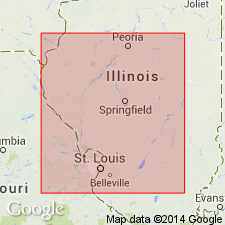
Named from exposures along creek that flows through "The Narrows" just northeast of Nutwood, in SE/4 NE/4 sec. 33 and SW/4 NW/4 sec. 34, T. 8 N., R. 13 W. [area around Lat. 39 deg. 05 min. 42 sec. N., Long. 90 deg. 32 min. 12 sec. W., Nutwood 7.5-min quadrangle], and in bluff behind Tenneriffe School, in northwest corner sec. 9, T. 7 N., R. 13 W. [approx. Lat. 39 deg. 04 min. 18 sec. N., Long. 90 deg. 33 min. 21 sec. W., Hardin 15-min quadrangle, 1956 ed.], Jersey Co., west-central IL. Occupies limited area on Ozark uplift and Vandalia arch, extending northeastward from Mississippi River to Christian Co., west-central IL.
[Additional locality information from USGS historical topographic map collection TopoView; accessed April 21, 2023.]
Source: US geologic names lexicon (USGS Bull. 1200, p. 2785).
For more information, please contact Nancy Stamm, Geologic Names Committee Secretary.
Asterisk (*) indicates published by U.S. Geological Survey authors.
"No current usage" (†) implies that a name has been abandoned or has fallen into disuse. Former usage and, if known, replacement name given in parentheses ( ).
Slash (/) indicates name conflicts with nomenclatural guidelines (CSN, 1933; ACSN, 1961, 1970; NACSN, 1983, 2005, 2021). May be explained within brackets ([ ]).