- Usage in publication:
-
- Nowata shale
- Modifications:
-
- Original reference
- Dominant lithology:
-
- Shale
- Sandstone
- Coal
- AAPG geologic province:
-
- Chautauqua platform
Summary:
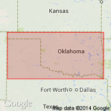
Pg. 28. Nowata shale. Bluish or greenish shales with a few sandstones and at least one bed of coal. Thickness 50 to 600 feet. Top formation of Tulsa group. Overlies Altamont limestone member of Oologah limestone and underlies Lenapah limestone. Age is Pennsylvanian.
Named from Nowata, Nowata Co., northeastern OK.
[Nowata shale. Adopted by the USGS. Recognized in northeastern Oklahoma and southern Kansas.]
Source: US geologic names lexicon (USGS Bull. 896, p. 1519).

- Usage in publication:
-
- Nowata shale*
- Modifications:
-
- Overview
- AAPG geologic province:
-
- Chautauqua platform
Summary:
Nowata shale. In Oklahoma is treated by U.S. Geological Survey as a distinct formation, and in Kansas as a member of Parsons formation. But R.C. Moore has recently (Kansas Geol. Survey Bull., no. 22, 1936) discarded Parsons formation and treats Nowata shale as a formation in his Marmaton group. These changes have not been considered by U.S. Geological Survey for its publications.
Source: US geologic names lexicon (USGS Bull. 896, p. 1519).
For more information, please contact Nancy Stamm, Geologic Names Committee Secretary.
Asterisk (*) indicates published by U.S. Geological Survey authors.
"No current usage" (†) implies that a name has been abandoned or has fallen into disuse. Former usage and, if known, replacement name given in parentheses ( ).
Slash (/) indicates name conflicts with nomenclatural guidelines (CSN, 1933; ACSN, 1961, 1970; NACSN, 1983, 2005, 2021). May be explained within brackets ([ ]).

