The National Geologic Map Database is migrating to a new infrastructure. We apologize for any service disruptions during this process.
|
|---|


- Usage in publication:
-
- Northwestern formation
- Modifications:
-
- Original reference
- Dominant lithology:
-
- Schist
- Quartzite
- AAPG geologic province:
-
- Midcontinent region
Summary:
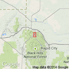
Pg. 793-799, 836-843, with maps. Northwestern formation. Essentially green, finely foliated garnet-mica schists interstratified with thin micaceous quartzites. Thickness 2,200 feet. Underlies Garfield formation; overlies West Lodge formation. Contrasts sharply with overlying and underlying formations. Mapped north and west of Lead, South Dakota. Age is Precambrian. Believed to be Keewatin age (Archean). Report includes geologic map.
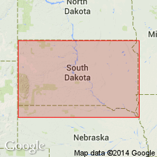
Named from exposures in cuts of Chicago and Northwestern RR between Lead and Blacktail, [Homestake Mine area, Lead district], Lawrence Co., southwestern SD.
Source: US geologic names lexicon (USGS Bull. 896, p. 1516); supplemental information from GNU records (USGS DDS-6; Denver GNULEX).
- Usage in publication:
-
- Northwestern formation
- Modifications:
-
- Contact revised
- AAPG geologic province:
-
- Midcontinent region
Summary:
Upper contact revised in that Northwestern formation unconformably underlies the Flag Rock formation (first used). Consists of mica schist about 4,000 ft thick. Overlies Ellison formation. Of pre-Cambrian age. The Lead area is in Lawrence Co, SD in the Midcontinent region.
Source: GNU records (USGS DDS-6; Denver GNULEX).

- Usage in publication:
-
- Northwestern Formation*
- Modifications:
-
- Age modified
- Overview
- AAPG geologic province:
-
- Midcontinent region
Summary:
Mapped in the Lead area, Lawrence Co, SD in Midcontinent region with Early Proterozoic unit Xsi (Pl. 1). Conformably overlies the Ellison Formation and is truncated south of Deadwood by the overlying Flag Rock Formation. Is correlated with the Irish Gulch Slate. May not be a valid formation; may be part of Ellison or Flag Rock Formation. Geologic map.
Source: GNU records (USGS DDS-6; Denver GNULEX).
For more information, please contact Nancy Stamm, Geologic Names Committee Secretary.
Asterisk (*) indicates published by U.S. Geological Survey authors.
"No current usage" (†) implies that a name has been abandoned or has fallen into disuse. Former usage and, if known, replacement name given in parentheses ( ).
Slash (/) indicates name conflicts with nomenclatural guidelines (CSN, 1933; ACSN, 1961, 1970; NACSN, 1983, 2005, 2021). May be explained within brackets ([ ]).