


- Usage in publication:
-
- Northeast shale
- Modifications:
-
- Original reference
- Dominant lithology:
-
- Shale
- AAPG geologic province:
-
- Appalachian basin
Summary:
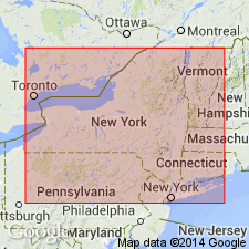
Pg. 69. Northeast shale. Applied to beds overlying Shumla sandstone and unconformably underlying Volusia shale in Chautauqua County, western New York, the unconformity representing Cuba sandstone. [Age is Late Devonian.]
Source: US geologic names lexicon (USGS Bull. 896, p. 1511-1512).
- Usage in publication:
-
- Northeast shale
- Modifications:
-
- Principal reference
- Dominant lithology:
-
- Shale
- AAPG geologic province:
-
- Appalachian basin
Summary:
Pg. 152. Shumla sandstone initiates over 400 feet of beds in no wise different from the Gowanda and Westfield as they enter the State. These, the "Portage flags" of I.C. White, are here renamed Northeast shale, from township in Erie County, western Pennsylvania. Fully exposed (about 415 feet) in Chautauqua Creek gulf and on the Canadaway (Arkwright Falls) above Shumla. Here nearly barren, but eastward they assume an easily recognized fauna, best exhibited in Pierce County west of Machias. [See explanation about this fauna under Machias fauna.] Northeast shale is part of Wellsburg sandstone to east. Included in Chautauquan [Chemung] of New York Survey. [Age is Late Devonian.]
Source: US geologic names lexicon (USGS Bull. 896, p. 1511-1512).

- Usage in publication:
-
- Northeast shale
- Modifications:
-
- Revised
- AAPG geologic province:
-
- Appalachian basin
Summary:
Pg. 369. Placed Northeast shale below Cuba sandstone and above Shumla sandstone, and included them all in Chemung. [Age is Late Devonian.]
Source: US geologic names lexicon (USGS Bull. 896, p. 1511-1512).
- Usage in publication:
-
- Northeast shale
- Modifications:
-
- Areal extent
- Dominant lithology:
-
- Shale
- AAPG geologic province:
-
- Appalachian basin
Summary:
Pg. 71. Restudy of Upper Devonian correlation problems in southwestern New York indicates a discrepancy in thicknesses along Genessee River and at Lake Erie of beds formerly supposed to be identical, which may require some further examination in field before publication of map. Former revisions may not have gone far enough in their departure from old ideas. The beds involved are only those above Dunkirk black shale, whose continuity with Canaseraga sandstones above the Wiscoy shale has been amply corroborated. It now seems likely, however, that the Cuba sandstone, 835 feet above the Dunkirk along Genesee River, goes below, instead of above, Northeast shales at Lake Erie, whose base there is 526 feet above the Dunkirk, and their top, 1,001 feet. With the known westward thinning of all these Upper Devonian strata, generally to above 98.52 percent a mile northwest, which would bring the Cuba top down to 484 feet above the Dunkirk, the Cuba seems likely to connect with Shumla sandstone, and the Northeast to embrace all beds above it, perhaps including the Cattaraugus. Consequently it becomes desirable to introduce local names for two of these members on the Genesee-Olean meridian, namely, Cadis beds for the supposed "Volusia" between the Cuba and the Hinsdale sandstones, and Haymaker beds for those formerly taken for the Chadakoin, between HInsdale ("quarry") sandstone and Wolf Creek conglomerate. The succession thus becomes Cuba, Cadiz, Hinsdale, Haymaker. In any event, it grows increasingly clearer that there are no Mississippian strata in New York.
Source: US geologic names lexicon (USGS Bull. 896, p. 1511-1512).
For more information, please contact Nancy Stamm, Geologic Names Committee Secretary.
Asterisk (*) indicates published by U.S. Geological Survey authors.
"No current usage" (†) implies that a name has been abandoned or has fallen into disuse. Former usage and, if known, replacement name given in parentheses ( ).
Slash (/) indicates name conflicts with nomenclatural guidelines (CSN, 1933; ACSN, 1961, 1970; NACSN, 1983, 2005, 2021). May be explained within brackets ([ ]).