

- Usage in publication:
-
- Northampton Till
- Modifications:
-
- Overview
- Dominant lithology:
-
- Till
- Clay
- AAPG geologic province:
-
- Appalachian basin
Summary:
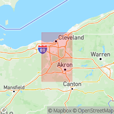
Northampton Till, named after exposure of gray clay till in an abandoned gravel pit in Northampton Township, northern Summit Co., OH, is described. Unweathered till is gray to dark gray, firm, jointed, and calcareous. Average texture is 9.9 percent sand, 48 percent silt, and 42.1 percent clay. Contains 6.6 percent dolomite and 3.5 percent calcite. Two beds occur north of Rte 303, separated by Lake Independence lacustrine deposits. At Nursery section, lower(?) bed measures 10 m and overlies Mississippian Bedford Shale. Elsewhere overlies Mogadore Till. Lower 2.5 m characterized by boulders and silty matrix. At Snowville Road section, upper(?) bed measures 8.25 m and underlies silty clay which shows affinity to Hiram or Lavery Tills. Dark gray Niagaran dolomite pebbles are common. Upper bed generally occurs at elevations greater than 800 ft. Defiance moraine marks southernmost limit of the upper bed. South of moraine, lower bed reaches elevations greater than 1000 ft and overlies older lake deposits. Age is middle Wisconsinan, probably Altonian.
Source: GNU records (USGS DDS-6; Reston GNULEX).
- Usage in publication:
-
- Northampton Till
- Modifications:
-
- Named
- Dominant lithology:
-
- Diamict
- Till
- AAPG geologic province:
-
- Appalachian basin
Summary:
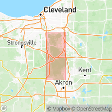
The Northampton Till is here proposed as a formal lithostratigraphic name for a pre-Woodfordian diamicton in northeastern OH. It is one of five tills that crop out in the study area. A type section is designated in the Peninsula quadrangle, northern Summit Co., and is referred to as the Woodbrook section. Unweathered Northampton is gray to dark gray, firm, jointed, calcareous silty clay till. Dolomite pebbles are common. The till weathers olive brown to dark brown. It is distinctive in that it has a matrix texture and carbonate content significantly different from the Mogadore and Kent Tills. Unit measures 2.21 m thick at the type section. It occurs elsewhere as two or more beds separated by lacustrine deposits (Lake Independence). It underlies the Lavery Till (at type) or the Kent Till and overlies sand and gravel of a deltaic sequence. Because of the controversy over possible middle Wisconsin glaciations, the Northampton, along with the Mogadore are here assigned to the large time interval referred to as pre-Woodfordian.
Source: GNU records (USGS DDS-6; Reston GNULEX).
For more information, please contact Nancy Stamm, Geologic Names Committee Secretary.
Asterisk (*) indicates published by U.S. Geological Survey authors.
"No current usage" (†) implies that a name has been abandoned or has fallen into disuse. Former usage and, if known, replacement name given in parentheses ( ).
Slash (/) indicates name conflicts with nomenclatural guidelines (CSN, 1933; ACSN, 1961, 1970; NACSN, 1983, 2005, 2021). May be explained within brackets ([ ]).