

- Usage in publication:
-
- North Creek member
- Modifications:
-
- Original reference
- Dominant lithology:
-
- Clay
- AAPG geologic province:
-
- Mid-Gulf Coast basin
Summary:
Pg. 1838 (fig. 6), 1839 (footnote). North Creek (clay) member of Yazoo clay. Proposed for an average an average of 40 feet of green or gray slightly glauconitic, fossiliferous clay, underlain by Moodys sand and overlain by Pachuta marl member (new) or Cocoa sand. [Age is late Eocene. Recognized in eastern Mississippi and western Alabama.]
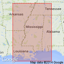
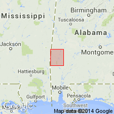
Type locality: on west side of North [Twistwood] Creek, 2 mi southwest of Rose Hill along State Highway [18] to Gridley and Turnersville, in SW/4 sec. 1, T. 3 N., R. 12 E., [approx. Lat. 32 deg. 07 min. 45 sec. N., Long. 89 deg. 01 min. 30 sec. W., Hero 7.5-min quadrangle], Jasper Co., eastern MS.
Source: US geologic names lexicon (USGS Bull. 1200, p. 2766).
- Usage in publication:
-
- North Creek member
- Modifications:
-
- Areal extent
- AAPG geologic province:
-
- Mid-Gulf Coast basin
Summary:
Pg. 121, 124, pl. 3. North Creek member of Yazoo clay. In Choctaw County, western Alabama, consists of greenish-gray plastic calcareous sparsely fossiliferous clay with white lime nodules and thin white sand streaks; base marked by a calcareous sandstone 2 to 12 inches thick. Thickness 50 to 60 feet. [Age is late Eocene.]
Source: US geologic names lexicon (USGS Bull. 1200, p. 2766).
- Usage in publication:
-
- North Twistwood Creek Member
- Modifications:
-
- Principal reference
- AAPG geologic province:
-
- Mid-Gulf Coast basin
Summary:
p. 97-99. North Twistwood Creek Member of Yazoo Clay. Proposed as corrected name to replace North Creek clay (Murray, 1947), a unit of Jackson group. Type exposures are on North Twistwood Creek, not on North Creek as stated in reference in which name was established. Status of unit as a member or formation should be based upon judgment of Yazoo clay, of which it is a subdivision, as a member, as a formation, or as a group. Age is late Eocene. Recognized in central and eastern Mississippi and western Alabama.
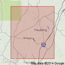
Type section: on west side of North Twistwood Creek in SW/4 sec. 1, T. 3 N., R. 12 E., Jasper Co., 2 mi southwest of Rose Hill along state highway [18] to Bay Springs [about 20 mi to southeast], MS.
Source: US geologic names lexicon (USGS Bull. 1350, p. 534).

- Usage in publication:
-
- North Twistwood Creek Clay Member
- Modifications:
-
- Overview
- AAPG geologic province:
-
- Mid-Gulf Coast basin
Summary:
Pg. 65, pl. North Twistwood Creek Clay Member of Yazoo Clay of Jackson Group. Greenish-gray slightly calcareous and plastic clay. Lithologically, this member may range from a pure montmorillonite clay to a lignitic, zeolitic, micaceous, calcareous, sandy clay to a micaceous, calcareous, argillaceous sand. Present in south Alabama. Thickness 32 feet on Sepulga River to 60 feet in southwest Alabama. Underlies Cocoa Sand Member of Yazoo Clay and overlies Moodys Branch Formation, basal formation of Jackson Group. Age is late Eocene (early Priabonian).
Source: Publication.
For more information, please contact Nancy Stamm, Geologic Names Committee Secretary.
Asterisk (*) indicates published by U.S. Geological Survey authors.
"No current usage" (†) implies that a name has been abandoned or has fallen into disuse. Former usage and, if known, replacement name given in parentheses ( ).
Slash (/) indicates name conflicts with nomenclatural guidelines (CSN, 1933; ACSN, 1961, 1970; NACSN, 1983, 2005, 2021). May be explained within brackets ([ ]).