

- Usage in publication:
-
- North Standard Latite*
- Modifications:
-
- Named
- Dominant lithology:
-
- Tuff
- Latite
- Agglomerate
- AAPG geologic province:
-
- Wasatch uplift
Summary:
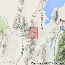
Named as lowermost of three formations of Laguna Springs Volcanic Group (revised; rank raised) for exposures (designated type locality) in area of North Standard shaft in secs 27 and 34, T9S, R2W, Utah Co, UT on Wasatch uplift. Fills a northeasterly trending valley that had been eroded into Latite Ridge Latite of Tintic Mountain Volcanic Group (both new), Packard Quartz Latite, and Paleozoic rocks after eruption of Tintic Mountain volcanic rocks. Prior to the lava extrusion of North Standard, valley was filled with alluvium, colluvium, and fine-grained tuff--here informally designated the lower member. This tuff member is agglomerate containing large proportion of partly rounded boulders 10-12 inches in diameter embedded in a matrix of volcanic ash and gravel. Much of the coarse material was derived from weathering of older volcanic rocks; original composition not well known because of moderate to strong hydrothermal alteration. The latitic flow rocks (dull-purplish-gray to brownish-gray, massive, fine- to medium-grained porphyry) that overlie this are informally designated the upper flow member. The abundance of hornblende and relative absence of quartz and hypersthene readily distinguish North Standard Latite from underlying Tintic Mountain Volcanic Group (new) and Packard Quartz Latite (which in turn underlies Tintic Mountain Volcanic Group). Is middle Oligocene based on stratigraphic position. Geologic map, sections.
Source: GNU records (USGS DDS-6; Denver GNULEX).
For more information, please contact Nancy Stamm, Geologic Names Committee Secretary.
Asterisk (*) indicates published by U.S. Geological Survey authors.
"No current usage" (†) implies that a name has been abandoned or has fallen into disuse. Former usage and, if known, replacement name given in parentheses ( ).
Slash (/) indicates name conflicts with nomenclatural guidelines (CSN, 1933; ACSN, 1961, 1970; NACSN, 1983, 2005, 2021). May be explained within brackets ([ ]).