

- Usage in publication:
-
- North Range Group
- Modifications:
-
- Mapped 1:250k
- Dominant lithology:
-
- Slate
- Siltstone
- Graywacke
- Iron-formation
- Sandstone
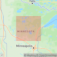
- AAPG geologic province:
-
- Lake Superior region
Summary:
Is Early Proterozoic group mapped as five separate map units in Crow Wing and western Aitkin Cos, central MN (Lake Superior region). Is comprised of three formations (descending): Rabbit Lake Formation, Trommald Formation, and Mahnomen Formation. Unconformably overlies Mille Lacs Group (Early Proterozoic) in the external zone of the fold-and-thrust belt of the Penokean orogen. Is interpreted to be below an unconformity that is correlative with an unconformity below the Animikie Group (Early Proterozoic) of the foreland basin of the Penokean orogen.
Source: GNU records (USGS DDS-6; Denver GNULEX).
For more information, please contact Nancy Stamm, Geologic Names Committee Secretary.
Asterisk (*) indicates published by U.S. Geological Survey authors.
"No current usage" (†) implies that a name has been abandoned or has fallen into disuse. Former usage and, if known, replacement name given in parentheses ( ).
Slash (/) indicates name conflicts with nomenclatural guidelines (CSN, 1933; ACSN, 1961, 1970; NACSN, 1983, 2005, 2021). May be explained within brackets ([ ]).