- Usage in publication:
-
- North Horn formation
- Modifications:
-
- Revised
- AAPG geologic province:
-
- Paradox basin
Summary:
Upper or Paleocene part of North Horn formation [whose definition and description was published five years after this paper] is named Joes Valley member of North Horn. Name North Horn applied to a sequence of fossiliferous clay, sandy clay, and sandstone that occur conformably above the Price River formation and below the Flagstaff limestone. Thickness not stated. Geologic map of area from North Horn Mountain, Emery Co, west to the Sanpete Co line, Paradox basin. Fossils described from North Horn. Dinosaurs identified from Upper Cretaceous part; mammal fossils from upper or Paleocene part.
Source: GNU records (USGS DDS-6; Denver GNULEX).
- Usage in publication:
-
- North Horn formation*
- Modifications:
-
- Named
- Dominant lithology:
-
- Shale
- Sandstone
- Limestone
- AAPG geologic province:
-
- Paradox basin
- Wasatch uplift
Summary:
Name applied to rocks formerly assigned to the lower member of Wasatch formation. Type locality is on North Horn Mountain, Ts18 and 19S, R6E, Emery Co, UT, Paradox basin where a section 1,650 ft thick measured and described. Divided into 4 units at type locality. Unit 4, a gentle slope-former, at base consists of 850 ft of gray to variegated shale, buff to gray, fine to medium sandstone, minor limestone, and is of flood-plain origin. Unit 3, a steep slope-former, is 250 ft thick of gray to black shale, buff, cream, gray, fine-grained sandstone, some limestone, and mainly of lacustrine origin. Unit 2, a gentle slope-former, is a 300 ft thick, gray to variegated with thin buff sandstone beds, of flood-plain origin. Unit 1, at top a steep slope former, is 250 ft thick, red and of gray to variegated shale interbedded with buff, irregularly bedded sandstone which are of lacustrine origin. Contains a few thin coals. Traceable over 600 sq mi, west into Wasatch uplift. Fourfold division not recognized over large area. Thickens north and east to 2,200 to 2,500 ft. Lower contact gradational with Price River formation. Upper contact with Flagstaff limestone (revised). Dinosaur fossils of Late Cretaceous age from lower part. Middle part unfossiliferous. Upper part has mammalian bones of Paleocene age. Stratigraphic table.
Source: GNU records (USGS DDS-6; Denver GNULEX).
- Usage in publication:
-
- North Horn Formation
- Modifications:
-
- Contact revised
- AAPG geologic province:
-
- Wasatch uplift
Summary:
Upper contact revised where unit underlies newly named Cedar Breaks Formation. Overlying rocks in Pavant Mountains of central UT, Sevier Co, [Wasatch uplift] that were previously referred to as Flagstaff Formation (not used) are now assigned to Cedar Breaks.
Source: GNU records (USGS DDS-6; Denver GNULEX).
- Usage in publication:
-
- North Horn Formation*
- Modifications:
-
- Areal extent
- AAPG geologic province:
-
- Uinta basin
Summary:
Areal limits of formation extended to include subsurface of southwest, central, and northern parts of Uinta basin. Underlies Flagstaff Member which is reduced in stratigraphic rank from formation and placed in the Green River Formation as its basal member. Is of latest Cretaceous and Paleocene age. Includes rocks of alluvial, paludal, and locally of lacustrine origin.
Source: GNU records (USGS DDS-6; Denver GNULEX).
- Usage in publication:
-
- North Horn Formation
- Modifications:
-
- Areal extent
- AAPG geologic province:
-
- Wasatch uplift
Summary:
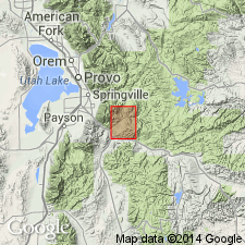
The conglomerate exposed in Red Narrows Canyon which was mapped as Red Narrows facies of North Horn Formation by Merrill (1972) and as part of Price River Formation by Spieker (1946) is named Red Narrows Conglomerate. The newly named conglomerate extends at least 10 mi south and 5 mi east of Billie's Mountain quad, Utah Co, UT, Wasatch uplift. Lower and middle members of Red Narrows intertongue with North Horn. Geologic map. Cross section. North Horn is an Upper Cretaceous and Paleocene unit.
Source: GNU records (USGS DDS-6; Denver GNULEX).
- Usage in publication:
-
- North Horn Formation*
- Modifications:
-
- Age modified
- AAPG geologic province:
-
- Wasatch uplift
Summary:
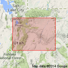
Ranges in age from Maestrichtian to early Eocene. The early Eocene age is based on interpreted age of palynomorphs in the Sanpete Valley, San Pete Co, UT on the Wasatch uplift. The fossils occur in the Flagstaff Limestone which intertongues with and overlies the North Horn. Eastward between the Wasatch Plateau to the Price River area in Carbon Co, UT in the Uinta basin, the age of the North Horn is limited to Maestrichtian to late Paleocene.
Source: GNU records (USGS DDS-6; Denver GNULEX).
- Usage in publication:
-
- North Horn Formation*
- Modifications:
-
- Principal reference
- Dominant lithology:
-
- Coal
- Mudstone
- Claystone
- Siltstone
- Sandstone
- AAPG geologic province:
-
- Uinta basin
Summary:
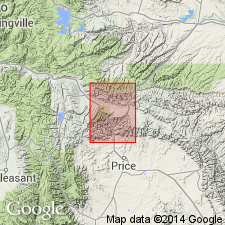
Section in Price Canyon in NE part sec 21 and SW part of sec 15, T12S, R9E, Carbon Co, UT in the Uinta basin designated the principal reference section. Boundary with overlying Flagstaff Member placed at base of a series of resistant argillaceous and fossiliferous carbonate rocks intercalated with lesser amounts of claystone and sandstone. Basal 0-50 m assigned to Late Cretaceous (Maestrichtian) based on palynomorphs, charophytes, and mollusks. Middle and late Paleocene age based on palynomorphs. [Early Paleocene is probably present but not specifically recognized.] Composed of: interbedded carbonate mudstone, carbonate wackestone, and claystone in basal 30 m; thin, lipid-rich coal beds interbedded with laminated carbonate wackestone 400-450 m thick; upper part of intercalated sandstone, siltstone, claystone, and clay-rich carbonate. Upper part of North Horn and Flagstaff Member are coeval with the Flagstaff Formation in the Wasatch Plateau.
Source: GNU records (USGS DDS-6; Denver GNULEX).
- Usage in publication:
-
- North Horn Formation*
- Modifications:
-
- Overview
- AAPG geologic province:
-
- Paradox basin
Summary:
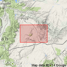
Tertiary-Cretaceous boundary placed above a bleached zone, a distinctive, well-developed, easily recognized, and readily traceable zone of kaolinite-rich beds. Rocks west of Desolation Canyon above the bleached zone assigned to the Paleocene North Horn Formation and Flagstaff Member of Green River Formation undivided. This zone is recognized also in Piceance basin, CO, between the Upper Cretaceous Ohio Creek Member of Mesaverde Formation, or Ohio Creek Member of Hunter Canyon Formation of Mesaverde Group, and the overlying Paleocene and Eocene Wasatch Formation. Underlying Upper Cretaceous rocks belong to Price River Formation of Mesaverde Group. Flagstaff and Price River mapped in northeast corner of map area south of the Roan Cliffs, Emery Co, UT in Paradox basin. Rocks east of Desolation Canyon above the bleached zone assigned to Paleocene North Horn Formation and Flagstaff Member of Green River Formation. Underlying rocks assigned to Upper Cretaceous Tuscher Formation of Mesaverde Group. Tuscher mapped along east-central edge of map.
Source: GNU records (USGS DDS-6; Denver GNULEX).
- Usage in publication:
-
- North Horn Formation*
- Modifications:
-
- Overview
- Areal extent
- AAPG geologic province:
-
- Uinta basin
Summary:
Crops out in Diamond Fork region, western Uinta basin, and along southwest margin of same basin. Geologic map. Contains thick beds of cobble conglomerate that represent proximal alluvial facies. Is correlative with Currant Creek Formation of northwest part of basin. Top of North Horn defined by lacustrine rocks of Flagstaff Member of the Green River Formation, whereas top of Currant Creek defined by alluvial rocks of Duchesne River Formation. Name North Horn not used at north margin of basin. Basal part in Price Canyon may be as old as late Campanian. Known to be early Maestrichtian to Paleocene.
Source: GNU records (USGS DDS-6; Denver GNULEX).
- Usage in publication:
-
- North Horn Formation*
- Modifications:
-
- Revised
- AAPG geologic province:
-
- Wasatch uplift
Summary:
Divisible into 8 informal units on eastern flank of San Pitch Mountains, Sanpete Co., UT, Wasatch uplift. Is variable in thickness and lithology in report area. Deposited in a nonmarine environment of alluvial fans, varied fluvial and overbank, and lacustrine environments. Has an exposed thickness of 138 ft on eastern flank of range and a thickness of more than 3,600 ft in canyon exposures less than 2 km west of the eastern range flank. The units are (ascending order): basal (disconnected) conglomerate units (at Big Mountain and at Wales Gap) previously called Price River Formation; lower redbed unit; sheet sandstone unit; coal-bearing unit; Big Mountain unit; Coal Canyon unit; calcareous sandstone unit; upper redbed unit. A dominantly carbonate and shale unit between the calcareous siltstone unit and the upper redbed unit is named Wales Tongue of the Flagstaff Limestone; this carbonate and shale unit was been included in and mapped with North Horn in earlier reports. Nomenclature chart. Geologic maps. Cross section. Correlation chart. Mapped between T 17 S, R 2 E and T 15 S, R 2 E, Sanpete Co. Several unconformities present in the North Horn above the basal conglomerate. Overlies South Flat Formation (reinstated). Underlies Flagstaff Limestone in eastern San Pitch Mountains. Ranges in age from late Campanian (Late Cretaceous) to early Eocene in eastern San Pitch Mountains. Dinosaur bones occur at least 300 m above base of northernmost measured section. Charophytes and ostracodes of late Campanian to early Maastrichtian age 135 ft above base at Petes Canyon. North Horn of eastern San Pitch Mountains ranges from late Campanian to late Ypresian, or Late Cretaceous to Eocene. North Horn on the western Wasatch Plateau ranges from late Maastrichtian to early Thanetian (Paleocene). Lower units of eastern San Pitch Mountains correlate with Sixmile Canyon and Price River Formations of the western Wasatch Plateau. Upper units of North Horn of eastern San Pitch Mountains correlate with lower Flagstaff of the western Wasatch Plateau.
Source: GNU records (USGS DDS-6; Denver GNULEX).
For more information, please contact Nancy Stamm, Geologic Names Committee Secretary.
Asterisk (*) indicates published by U.S. Geological Survey authors.
"No current usage" (†) implies that a name has been abandoned or has fallen into disuse. Former usage and, if known, replacement name given in parentheses ( ).
Slash (/) indicates name conflicts with nomenclatural guidelines (CSN, 1933; ACSN, 1961, 1970; NACSN, 1983, 2005, 2021). May be explained within brackets ([ ]).

