The National Geologic Map Database is migrating to a new infrastructure. We apologize for any service disruptions during this process.
|
|---|


- Usage in publication:
-
- Norphlet Formation
- Modifications:
-
- Overview
- Dominant lithology:
-
- Shale
- Sandstone
- Redbeds
- AAPG geologic province:
-
- Mid-Gulf Coast basin
Summary:
Norphlet Formation is a regionally extensive, predominantly continental, clastic deposit. Four lithofacies have been recognized: basal shale, a conglomeratic sandstone, red beds, and an upper quartzose sandstone. Reworked sandstones occur at the top. Maximum thickness in Mississippi interior salt basin 900 ft. Conformably overlies the Pine Hill Anhydrite Member of the Louann Salt and disconformably overlies the Werner Formation, the Eagle Mills Formation or basement rocks. Age is believed to be Oxfordian (Salvador, 1987).
Source: GNU records (USGS DDS-6; Reston GNULEX).
- Usage in publication:
-
- Norphlet Formation*
- Modifications:
-
- Overview
- AAPG geologic province:
-
- Mid-Gulf Coast basin
Summary:
Overlies Louann Salt, Werner Formation, Eagle Mills Formation or basement rock. Underlies Smackover Formation. Extends from east TX to panhandle of FL. Is thickest in central and eastern MS where it can be up to 700 ft thick. Thicknesses vary over short distances. Uplifted blocks may have been sediment source areas during Norphlet deposition. Four facies recognized: 1) black shale facies found in lower part of formation, is restricted to eastern MS salt basin and southern AL, and formed as a restricted bay or lagoon deposit; 2) conglomerate facies found in updip areas in AL and along margins of some basin uplifts, is gray to red, poorly sorted, fine to very coarse grained, has pebble- to cobble-size clasts of chert, shale, quartzite, rhyolite, metamorphic rocks, and was a proximal fan and wadi deposit; 3) redbed facies of red sandstone, siltstone, and mudstone interpreted to be distal alluvial fan and fluvial wadi deposit; 4) quartzose sandstone facies of fine to very fine grained, moderately well to well sorted, gray to buff, feldspathic sandstone of Denkman Sandstone Member, at top of Norphlet. Stratigraphic chart. Late Jurassic age.
Source: GNU records (USGS DDS-6; Denver GNULEX).
- Usage in publication:
-
- Norphlet Sandstone
- Modifications:
-
- Revised
- AAPG geologic province:
-
- South Georgia sedimentary province
Summary:
Norphlet referred to as Sandstone rather than Formation. Lithology of the Norphlet in Gulf Co. consists predominantly of red to brown sandstones, siltstones and shales. Penetrated by three deep oil test wells. The Hunt Oil, International Paper Co. drilled 267 ft of Norphlet. The thickest Norphlet section was encountered in the Mesa Petroleum St. Joe Paper No. 1, which drilled 676 ft. Overlies unnamed volcanic and plutonic rocks and the Louann Salt. Unconformably underlies the Smackover Formation.
Source: GNU records (USGS DDS-6; Reston GNULEX).
- Usage in publication:
-
- Norphlet Formation
- Modifications:
-
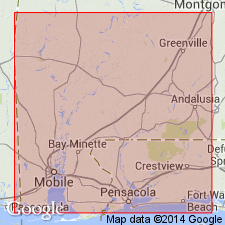
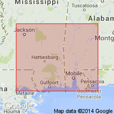
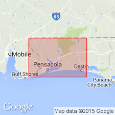
- Overview
- Areal extent
- AAPG geologic province:
-
- Mid-Gulf Coast basin
Summary:
Study area is confined to Escambia, Santa Rosa, and Okaloosa Cos., FL, where the Norphlet has been previously undocumented. Throughout panhandle, unit lies at depths greater than 13,000 ft below sea level. Wedges out in eastern-most Okaloosa Co. Unconformably overlies the Louann, Werner, or Eagle Mills Formations. Underlies the Smackover Formation. Norphlet varies in lithologic character across panhandle FL. The Denkman Member, at the top of the Norphlet, in central Escambia and Santa Rosa Cos. is characterized by relatively clean, light-colored sandstones. Grades into medium- to coarse-grained and gravelly sandstones to the east and south. In southern Santa Rosa Co., the Norphlet is represented by a 14.6-ft section of conglomerates and coarse grained sandstones. In western Okaloosa Co., it is characterized by coarse, red, lithic sandstones. Formation thins rapidly eastward from this area. Most complete section of Norphlet examined for this study is found in the core from the Mesa Petroleum well where 73 ft of continuous Norphlet strata were examined. Average thickness of the unit in panhandle FL is 122.9 ft. Reaches a maximum of 410 ft in the Champlin Petroleum well, western Okaloosa Co. Age is Late Jurassic (Oxfordian).
Source: GNU records (USGS DDS-6; Reston GNULEX).
For more information, please contact Nancy Stamm, Geologic Names Committee Secretary.
Asterisk (*) indicates published by U.S. Geological Survey authors.
"No current usage" (†) implies that a name has been abandoned or has fallen into disuse. Former usage and, if known, replacement name given in parentheses ( ).
Slash (/) indicates name conflicts with nomenclatural guidelines (CSN, 1933; ACSN, 1961, 1970; NACSN, 1983, 2005, 2021). May be explained within brackets ([ ]).