The National Geologic Map Database is migrating to a new infrastructure. We apologize for any service disruptions during this process.
|
|---|


- Usage in publication:
-
- Normanskill Group
- Modifications:
-
- Revised
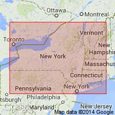
- Areal extent
- AAPG geologic province:
-
- New England province
Summary:
Used as [informal] Normanskill Group of Fisher (1984) in Glens Falls quad. Included as uppermost part of Taconic allochthon sequence. Overlies Ordovician Poultney Formation.
Source: GNU records (USGS DDS-6; Reston GNULEX).
- Usage in publication:
-
- Normanskill Formation
- Modifications:
-
- Revised
- Overview
- AAPG geologic province:
-
- Appalachian basin
Summary:
Normanskill Formation divided into lower and upper parts. Upper Normanskill, including the Austin Glen Member, is assigned by this author to the Tippecanoe Sequence. Lower Normanskill, including the Mount Merino Chert Member and the Indian River Slate Member, is assigned to the Taconic Sequence. Report includes lengthy discussion of the disagreement between Ruedemann and Ulrich upon the age and definition of the Normanskill. Ruedemann's (1901) unit is the Upper Normanskill of this report and is late Middle Ordovician. Author states that Ruedemann's original correlation of the Normanskill was correct and should have been the basis for recognizing a second, younger shale unit.
Source: GNU records (USGS DDS-6; Reston GNULEX).
For more information, please contact Nancy Stamm, Geologic Names Committee Secretary.
Asterisk (*) indicates published by U.S. Geological Survey authors.
"No current usage" (†) implies that a name has been abandoned or has fallen into disuse. Former usage and, if known, replacement name given in parentheses ( ).
Slash (/) indicates name conflicts with nomenclatural guidelines (CSN, 1933; ACSN, 1961, 1970; NACSN, 1983, 2005, 2021). May be explained within brackets ([ ]).