The National Geologic Map Database is migrating to a new infrastructure. We apologize for any service disruptions during this process.
|
|---|


- Usage in publication:
-
- Norman division
- Modifications:
-
- Named
- Dominant lithology:
-
- Shale
- Sandstone
- AAPG geologic province:
-
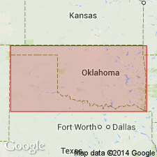
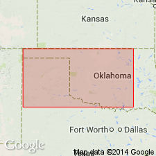
- Sedgwick basin
- Chautauqua platform
Summary:
Pg. 42, 43. Norman division. All rocks of Red-beds from base of that series to lowermost gypsum ledges on east slope of Gypsum Hills. Includes (ascending) Harper sandstone, Salt Plain measures, Cedar Hills sandstone, and lower part of Flowerpot [Flower-pot] shale. Chiefly brick-red clay shales with some interbedded ledges of red and whitish sandstone. To east sandstones predominate, but along base of Gypsum Hills the beds are almost wholly clay. Thickness unknown, but is not less than 1,200 feet. Covers an extensive area in Oklahoma (Chautauqua platform and Anadarko basin) and northward into Kansas (in the Sedgwick and Anadarko basins). Underlies Ferguson gypsum member of Blaine division, where that gypsum is present; elsewhere extends up to base of Medicine Lodge gypsum. Lower contact not described. Age is Permian.
Named from Norman, Cleveland Co., OK (Chautauqua platform). [According to GNU records (USGS DDS-6; Denver GNULEX, Sept. 24, 1987) type locality not designated.]
[GNC remark (ca. 1938, US geologic names lexicon, USGS Bull. 896, p. 1508): Later work showed that Norman, Cleveland Co., OK, is not on unit named; †Norman division abandoned.]
Source: US geologic names lexicon (USGS Bull. 896, p. 1508); supplemental information from GNU records (USGS DDS-6; Denver GNULEX).
- Usage in publication:
-
- Norman division†
- Modifications:
-
- Abandoned
Summary:
[Norman division apparently abandoned; author uses term Enid formation (here named) instead. No mention is made of the Norman division.] Enid underlies Blaine formation (revised). Enid is shown on accompanying geologic map as younger than the Pennsylvanian Marion and Wellington formations (grouped together in this report). Enid is Permian in upper part and Pennsylvanian in lower part. Report includes geologic map, columnar sections.
Source: GNU records (USGS DDS-6; Denver GNULEX).
For more information, please contact Nancy Stamm, Geologic Names Committee Secretary.
Asterisk (*) indicates published by U.S. Geological Survey authors.
"No current usage" (†) implies that a name has been abandoned or has fallen into disuse. Former usage and, if known, replacement name given in parentheses ( ).
Slash (/) indicates name conflicts with nomenclatural guidelines (CSN, 1933; ACSN, 1961, 1970; NACSN, 1983, 2005, 2021). May be explained within brackets ([ ]).