

- Usage in publication:
-
- Norfleet limestone member
- Modifications:
-
- Named
- Dominant lithology:
-
- Limestone
- Shale
- AAPG geologic province:
-
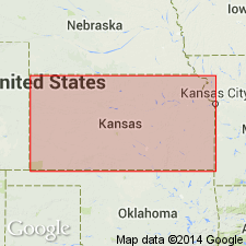
- Cherokee basin
Summary:
Named as basal member (of 3) of Lenapah limestone of the Marmaton group in southeastern KS; named from the Ivy Norfleet farm northeast of Mound Valley, in sec 35, T32S, R18E, Labette Co, KS. Type exposure 8 ft thick designated on the Norfleet farm along Pumpkin creek north of the low-water bridge in SE1/4 sec 35, T32S, R18E, northeast of Mound Valley, Labette Co, KS in the Cherokee basin. Other measured sections. Near Mound Valley, consists of a few inches of dark, bluish-gray, dense limestone overlain by mostly black shale with a maximum thickness of 5 ft. Locally upper part of the rock is very calcareous, black and platy. A limestone exists at top of the member, which is a few inches to about 3 ft thick; ranges from dense dove-gray to dark slabby limestone and limestone breccia. Hummocky outcrops; brachiopod DICTYOCLOSTUS; crinoid stems. Overlies Nowata shale of Marmaton group; underlies Perry Farm shale member (new) of Lenapah limestone of Marmaton. Cross section. Of Pennsylvanian, Des Moines age.
Source: GNU records (USGS DDS-6; Denver GNULEX).
For more information, please contact Nancy Stamm, Geologic Names Committee Secretary.
Asterisk (*) indicates published by U.S. Geological Survey authors.
"No current usage" (†) implies that a name has been abandoned or has fallen into disuse. Former usage and, if known, replacement name given in parentheses ( ).
Slash (/) indicates name conflicts with nomenclatural guidelines (CSN, 1933; ACSN, 1961, 1970; NACSN, 1983, 2005, 2021). May be explained within brackets ([ ]).