The National Geologic Map Database is migrating to a new infrastructure. We apologize for any service disruptions during this process.
|
|---|


- Usage in publication:
-
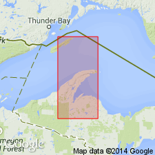
- Nonesuch shale belt*
- Modifications:
-
- Named
- Dominant lithology:
-
- Shale
- Sandstone
- AAPG geologic province:
-
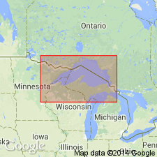
- Wisconsin arch
Summary:
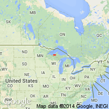
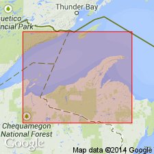
Named for Nonesuch mine, Gogebic Co., Upper Peninsula of northwestern MI. Consists of black shale and gray sandstone. Near base, contains sandstone seam worked for its copper and known as Nonesuch lode. Thickness is over 200 ft. Overlies Outer conglomerate; underlies red sandstone. Age is Precambrian.
Source: GNU records (USGS DDS-6; Reston GNULEX).
- Usage in publication:
-
- Nonesuch formation*
- Modifications:
-
- Revised
- AAPG geologic province:
-
- Wisconsin arch
Summary:
Revised as Nonesuch formation. Consists of black shale and gray sandstone. Has been traced for 125 mi. Thickness varies from 125 to 500 ft. Contains large and sometimes dominant portion of basin detritus.
Source: GNU records (USGS DDS-6; Reston GNULEX).
- Usage in publication:
-
- Nonesuch formation
- Modifications:
-
- Revised
- AAPG geologic province:
-
- Wisconsin arch
Summary:
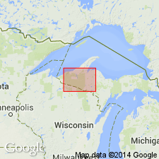
Nonesuch formation assigned to Oronto group which is named for exposures on Oronto Bay, Iron Co., northwestern WI. Occurs in Bayfield, Douglas, and Iron Cos. Consists of mostly nonmarine arkosic sandstones, conglomerates, and red shales. Thickness is about 21,500 ft. Top fixed at highest thick beds of red shales and well-marked arkosic sandstones. Conformably underlies Bayfield sandstone group; overlies middle and lower Keweenawan traps. No fossils present. Age is Precambrian (upper Keweenawan).
Source: GNU records (USGS DDS-6; Reston GNULEX).
- Usage in publication:
-
- Nonesuch shale*
- Modifications:
-
- Overview
- Dominant lithology:
-
- Siltstone
- Shale
- AAPG geologic province:
-
- Wisconsin arch
Summary:
Nonesuch shale used in this report for rocks that are predominantly siltstone. Upper part composed of flaggy, ripple-marked gray and reddish-gray siltstone with subordinate amounts of interbedded gray and greenish-gray silty shale. Well-displayed in road ditch in SW1/4 sec. 33, T57N, R33W. Lower 200 ft concealed by overburden; in adjacent Hancock quad, lower part is dark-gray, thinly laminated siltstone with several beds of coarse-grained, arkosic sandstone near base. Total thickness is 600 ft. Age is Precambrian (upper Keweenawan).
Source: GNU records (USGS DDS-6; Reston GNULEX).
- Usage in publication:
-
- Nonesuch shale*
- Modifications:
-
- Revised
- AAPG geologic province:
-
- Wisconsin arch
Summary:
Informally subdivided into local terms (ascending): Parting shale, Upper sandstone, Upper shale, Striped bed, and Marker bed.
Source: GNU records (USGS DDS-6; Reston GNULEX).
- Usage in publication:
-
- Nonesuch Shale*
- Modifications:
-
- Revised
- AAPG geologic province:
-
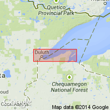
- Lake Superior region
Summary:
Revised, now forming basal formation in Oronto Group. Overlies Copper Harbor Conglomerate (revised) and underlies Freda Sandstone. Base of unit considered boundary between middle and upper Keweenawan sequence in Lake Superior region. Is late Precambrian in age.
Source: GNU records (USGS DDS-6; Denver GNULEX).
- Usage in publication:
-
- Nonesuch Formation*
- Modifications:
-
- Revised
- Dominant lithology:
-
- Sandstone
- Siltstone
- AAPG geologic province:
-
- Wisconsin arch
Summary:
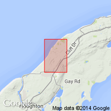
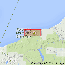
In Porcupine Mountains area, northwestern MI, Nonesuch Formation is used instead of Nonesuch Shale. Very fine to fine sandstone is more abundant that siltstone (shale of Irving, 1883, and other workers).
Source: GNU records (USGS DDS-6; Reston GNULEX).
- Usage in publication:
-
- Nonesuch Shale*
- Modifications:
-
- Revised
- Age modified
- AAPG geologic province:
-
- Wisconsin arch
Summary:
Nonesuch Shale, composed of siltstone, shale, and sandstone, is assigned to Oronto Group which is in turn assigned to Keweenawan Supergroup. Age is Proterozoic Y.
Source: GNU records (USGS DDS-6; Reston GNULEX).
- Usage in publication:
-
- Nonesuch Formation
- Modifications:
-
- Overview
- Geochronologic dating
- AAPG geologic province:
-
- Wisconsin arch
Summary:
The Nonesuch Formation has been informally subdivided into two subunits: the "upper" Nonesuch, which underlies the Freda Sandstone, extends to the base of the "stripey" shale, and the "lower" Nonesuch, which lies beneath the "stripey" shale and above the Copper Harbor Formation. The "stripey" shale is a distinct, laminated to thinly-bedded shale with very thin layers of calcite-cemented siltstone. The lower Nonesuch has been further subdivided into three informal intervals: the "parting" shale, the "upper" sandstone, and the "upper" shale. The entire Nonesuch ranges from 135 m to 220 m thick between Houghton, MI, and the MI/WI border. The "lower" Nonesuch ranges from 5 to 27 m. The copper ore deposits are confined to the "lower" Nonesuch. Depositional environment of the unit is controversial. Estuarine, tidal lagoon or mud flat, lagoonal or deltaic interdistributary, lacustrine, and marine have all been suggested. The base of the red massive siltstone within the parting shale of the lower Nonesuch has recently been dated at 1091+/-10 Ma, derived from 207Pb-206Pb isochron by Ohr and DeWolf (unpub. data). This age most likely represents the age of sedimentation.
Source: GNU records (USGS DDS-6; Reston GNULEX).
For more information, please contact Nancy Stamm, Geologic Names Committee Secretary.
Asterisk (*) indicates published by U.S. Geological Survey authors.
"No current usage" (†) implies that a name has been abandoned or has fallen into disuse. Former usage and, if known, replacement name given in parentheses ( ).
Slash (/) indicates name conflicts with nomenclatural guidelines (CSN, 1933; ACSN, 1961, 1970; NACSN, 1983, 2005, 2021). May be explained within brackets ([ ]).