- Usage in publication:
-
- Nolia Volcanic Formation*
- Modifications:
-
- Named
- Dominant lithology:
-
- Andesite
- AAPG geologic province:
-
- Basin-and-Range province
Summary:
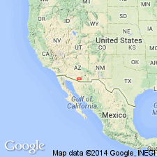
Named for village of Nolia, Pima Co, AZ in the Basin-and-Range province. No type locality designated, but excellently exposed near Nolia in Ko Vaya Hills. Extensively exposed in North and South Comobabi Mountains. Geologic map. Made up of brick-red, maroon, and black porphyritic andesitic to latitic flows and amygdaloidal andesite flows. Divisible into a lower sequence of dense reddish porphyritic andesitic to latitic flows and an upper sequence of greenish-black amygdaloidal andesite flows. Is partly metamorphosed in central parts of North and South Comobabi Hills where intruded by dioritic and monzonitic rocks. As much as 7,000 ft thick. Relations with other formations uncertain but definitely overlain by newly named Sand Wells Formation [Mesozoic] in North Comobabi Mountains. Presumed to be older than Cocoraque Formation (new) which contains fragments apparently derived from Nolia. Is of Mesozoic age.
Source: GNU records (USGS DDS-6; Denver GNULEX).
For more information, please contact Nancy Stamm, Geologic Names Committee Secretary.
Asterisk (*) indicates published by U.S. Geological Survey authors.
"No current usage" (†) implies that a name has been abandoned or has fallen into disuse. Former usage and, if known, replacement name given in parentheses ( ).
Slash (/) indicates name conflicts with nomenclatural guidelines (CSN, 1933; ACSN, 1961, 1970; NACSN, 1983, 2005, 2021). May be explained within brackets ([ ]).

