

- Usage in publication:
-
- Nokomis Sandstone Member
- Modifications:
-
- Original reference
- Dominant lithology:
-
- Sandstone
- AAPG geologic province:
-
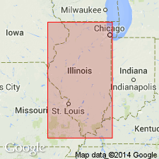
- Sioux uplift
- Wisconsin arch
Summary:
Pg. 13 (fig. 2), 51-52, 226. Nokomis Sandstone Member of Glenwood Formation of Ancell Group (new). Name applies to sandstone with Glenwood texture lying between St. Peter Sandstone and Harmony Hill Shale Member of Glenwood. It results from merger of Kingdom Sandstone and Loughridge Sandstone beyond the northern and western margin of intervening Daysville Dolomite Member. Maximum thickness nearly 11 feet in type section. Age is Middle Ordovician (Champlainian). Present in southeastern Minnesota, northwestern Illinois, northeastern Iowa, northern Michigan, and southwestern Wisconsin.
Type section: exposure in west bluff of Mississippi River at Lock and Dam No.1 in Minneapolis, in NW/4 SW/4 NW/4 sec. 17, T. 27 N., R. 23 W., St. Paul quadrangle, Hennepin Co., MN. Named from Lake Nokomis (formerly Amelia Lake) 1.5 mi west of type section.
Source: US geologic names lexicon (USGS Bull. 1350, p. 530).
- Usage in publication:
-
- Nokomis Bed
- Modifications:
-
- Revised
- AAPG geologic province:
-
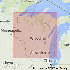
- Wisconsin arch
Summary:
Nokomis Bed of Glenwood Member of St. Peter Sandstone. Shown on columnar section as bed in Glenwood Member of St. Peter Sandstone. Underlies Harmony Hill Bed and overlies Tonti Member of St. Peter Sandstone. Age is Middle Ordovician (Champlainian).
Source: US geologic names lexicon (USGS Bull. 1350, p. 530).
For more information, please contact Nancy Stamm, Geologic Names Committee Secretary.
Asterisk (*) indicates published by U.S. Geological Survey authors.
"No current usage" (†) implies that a name has been abandoned or has fallen into disuse. Former usage and, if known, replacement name given in parentheses ( ).
Slash (/) indicates name conflicts with nomenclatural guidelines (CSN, 1933; ACSN, 1961, 1970; NACSN, 1983, 2005, 2021). May be explained within brackets ([ ]).