

- Usage in publication:
-
- Noh Formation
- Modifications:
-
- First used
- AAPG geologic province:
-
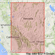
- Great Basin province
Summary:
Pg. 585 (fig. 3), 587 (fig. 4). Comparison of Lower Paleozoic volcanic and nonvolcanic geosynclinal belts in Nevada and Newfoundland. Noh Formation listed in table showing distribution of the sequences with argillites, cherts, and volcanics rocks in Nevada and Idaho. Thickness of formation 1,300+ feet. Occurs above Agort Chert (new). Present in northeastern Nevada. Age is Silurian.
Type locality and origin of name not stated.
Source: US geologic names lexicon (USGS Bull. 1350, p. 530).
- Usage in publication:
-
- Noh Formation
- Modifications:
-
- Named
- Dominant lithology:
-
- Chert
- Shale
- AAPG geologic province:
-
- Great Basin province
Summary:
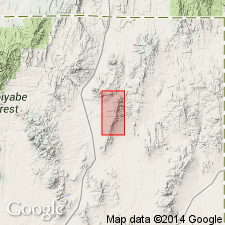
Named after Noh Springs on north flank of HD Range. Type section forms top of prominent conical hill overlooking Bell Canyon, 1 mi northwest of Bell Mine (abandoned), HD Range, northeast Elko Co, NV. At type consists of three units: (a) 140 ft of basal dark-gray chert and light-gray shale; (b) 400 ft of light-brown weathering siliceous and tuffaceous(?) siltstone and shale; and (c) at least 550 ft of tan- and light-brown-weathering, thin-bedded siltstone, sandstone, and minor shale. Total thickness is as much as 1,100 ft. Contains large and diagnostic Wenlockian graptolite fauna. Disconformably overlies Agort Chert (new) and locally, Tiser Limestone. Unconformably underlies Quilici Formation (new) (Middle Pennsylvanian) or Diamond Peak Formation (Mississippian). Is Silurian age based on graptolite fauna.
Source: GNU records (USGS DDS-6; Menlo GNULEX).
For more information, please contact Nancy Stamm, Geologic Names Committee Secretary.
Asterisk (*) indicates published by U.S. Geological Survey authors.
"No current usage" (†) implies that a name has been abandoned or has fallen into disuse. Former usage and, if known, replacement name given in parentheses ( ).
Slash (/) indicates name conflicts with nomenclatural guidelines (CSN, 1933; ACSN, 1961, 1970; NACSN, 1983, 2005, 2021). May be explained within brackets ([ ]).