- Usage in publication:
-
- Nizina limestone*
- Modifications:
-
- Named
- Dominant lithology:
-
- Limestone
- Shale
- AAPG geologic province:
-
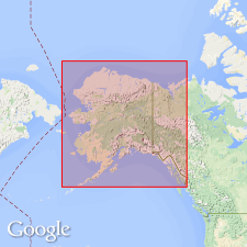
- Alaska Southern region
Summary:
Named for exposures on Nizina River. Type section designated in cliffs on west side of Nizina River opposite mouth of Chitistone River, Nizina-Tanana region, southern AK. Use of name "Nizina limestone" by Rohn (1900) appeared incidental as applied to Chitistone limestone. Here name Nizina limestone is applied to limestones of upper part of Chitistone. Consists of thin-bedded limestones with interstratified shale approximately 1000 to 1200 ft thick. Conformably overlies Chitistone limestone (restricted). Conformably(?) underlies McCarthy formation. In Kotsina and Kuskulana Valleys thickness is 500 to 3000 ft and contains fauna similar to Chitistone limestone. Age is Late Triassic.
Source: GNU records (USGS DDS-6; Menlo GNULEX).
For more information, please contact Nancy Stamm, Geologic Names Committee Secretary.
Asterisk (*) indicates published by U.S. Geological Survey authors.
"No current usage" (†) implies that a name has been abandoned or has fallen into disuse. Former usage and, if known, replacement name given in parentheses ( ).
Slash (/) indicates name conflicts with nomenclatural guidelines (CSN, 1933; ACSN, 1961, 1970; NACSN, 1983, 2005, 2021). May be explained within brackets ([ ]).

