The National Geologic Map Database is migrating to a new infrastructure. We apologize for any service disruptions during this process.
|
|---|


- Usage in publication:
-
- Nittany dolomite*
- Modifications:
-
- Named
- Dominant lithology:
-
- Dolomite
- AAPG geologic province:
-
- Appalachian basin
Summary:
Named the Nittany dolomite of the Beekmantown group for the Nittany Valley, Centre Co., PA. Consists of (ascending) thick-bedded, slightly calcareous, light to medium gray, crystalline, compact dolomite (624 feet); gray crystalline dolomite with some chert and sandstone (132 feet); alternating beds of light and dark gray crystalline dolomite (313 feet); and massive, light gray, finely crystalline dolomite (198 feet). Unit overlies the Stonehenge limestone and underlies the Axemann limestone, both of the Beekmantown group. The Nittany is of Early Ordovician age.
Source: GNU records (USGS DDS-6; Reston GNULEX).
- Usage in publication:
-
- Nittany dolomite
- Modifications:
-
- Areal extent
- AAPG geologic province:
-
- Appalachian basin
Summary:
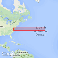
Geographically extended the Nittany dolomite into northeastern TN where unit is largely the dolomite equivalent of the Longview formation northwest of Clinch Mountain.
Source: GNU records (USGS DDS-6; Reston GNULEX).
- Usage in publication:
-
- Nittany formation
- Modifications:
-
- Revised
- AAPG geologic province:
-
- Appalachian basin
Summary:
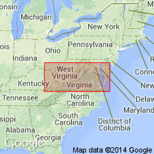
Revised the Nittany to the Nittany formation in northwestern VA. Unit is correlative to the upper part of the Beekmantown formation in other parts of the State. Consists of limestone and dolomite. Overlies the Bellefonte formation and underlies Middle Ordovician rocks. Nittany is of Early Ordovician age.
Source: GNU records (USGS DDS-6; Reston GNULEX).
- Usage in publication:
-
- Nittany Dolomite
- Modifications:
-
- Revised
- AAPG geologic province:
-
- Appalachian basin
Summary:
Subdivided the Nittany Dolomite in central PA into (ascending) Forge Union, Shoenberger, and Etna Furnace Members based on presence and absence of sand-size and silt-size quartz grains in dolomites. The Forge Union and Etna Furnace contain dolomite with sand- and silt-size quartz grains; the Shoenberger does not contain sand- and silt-size quartz grains.
Source: GNU records (USGS DDS-6; Reston GNULEX).
- Usage in publication:
-
- Nittany Formation
- Modifications:
-
- Revised
- AAPG geologic province:
-
- Appalachian basin
Summary:
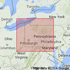
Revised the Nittany to the Nittany Formation in central PA. Consists of fine- to coarse-crystalline dolomite and contains interbeds of very fine-crystalline dolomite with almost complete lack of limestone interbeds. Anhydrite appears within formation in subsurface. The top of the Nittany is placed at the base of dolomites containing limestone interbeds. Overlies the Larke Formation in south-central PA and the Stonehenge Formation in north-central area; unconformably underlies the Bellefonte Formation in south-central PA and the Axemann Formation in north-central area. The Nittany is of Early Ordovician age.
Source: GNU records (USGS DDS-6; Reston GNULEX).
- Usage in publication:
-
- Nittany Formation
- Modifications:
-
- Overview
- AAPG geologic province:
-
- Appalachian basin
Summary:
The Nittany Formation in PA consists of medium to dark gray, thick-bedded dolomite containing chert and siliceous oolites. Unit overlies the Stonehenge Formation and underlies the Axemann Formation and is only mapped in the Nittany Arch of central PA. The Nittany is of Early Ordovician age.
Source: GNU records (USGS DDS-6; Reston GNULEX).
- Usage in publication:
-
- Nittany Formation
- Modifications:
-
- Overview
- Areal extent
- AAPG geologic province:
-
- Appalachian basin
Summary:
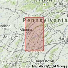
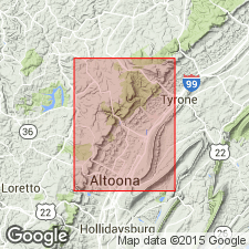
Unit extends from the Nittany Valley in central PA southwestward to western MD and western VA. It has also been traced in the subsurface under the Appalachian Plateau. Consists almost entirely of dolosiltite and fine-grained dolarenite, with some chert nodules or thin beds. Lower contact is not exposed in report area, but unit overlies the Stonehenge in adjacent quads. Upper contact with the Axemann is not exposed. Thickness in area is 260+ m. Best exposures are to the east in the Tyrone quad, along PA Rte 453.
Source: GNU records (USGS DDS-6; Reston GNULEX).
For more information, please contact Nancy Stamm, Geologic Names Committee Secretary.
Asterisk (*) indicates published by U.S. Geological Survey authors.
"No current usage" (†) implies that a name has been abandoned or has fallen into disuse. Former usage and, if known, replacement name given in parentheses ( ).
Slash (/) indicates name conflicts with nomenclatural guidelines (CSN, 1933; ACSN, 1961, 1970; NACSN, 1983, 2005, 2021). May be explained within brackets ([ ]).