The National Geologic Map Database is migrating to a new infrastructure. We apologize for any service disruptions during this process.
|
|---|


- Usage in publication:
-
- Newton sandstone
- Modifications:
-
- Original reference
- Dominant lithology:
-
- Sandstone
- AAPG geologic province:
-
- Appalachian basin
Summary:
Pg. 50-51, and under county descriptions. Newton sandstone. Top member of Bonair sandstone. Consists of 50 to 175 feet of soft coarse white, yellow, or reddish-white micaceous sandstone, generally strongly cross-bedded. In places there are thin ripple-marked beds and one or two coal beds. In northern part of field this sandstone rests on Eastland shale lentil of Bonair sandstone. In southern part of field it rests on Whitwell shale.
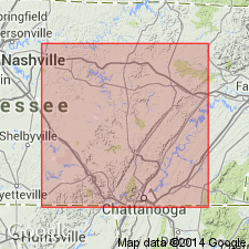
Recognized in Cumberland, Grundy, Hamilton, Van Buren, White, Bledsoe, Sequatchie, Rhea, and Marion Cos., southeastern TN. Named for fact that it occurs at Newton Post Office, in southwestern corner of Cumberland Co., southeastern TN.
Source: US geologic names lexicon (USGS Bull. 896, p. 1493).

- Usage in publication:
-
- Newton sandstone
- Modifications:
-
- Revised
- AAPG geologic province:
-
- Appalachian basin
Summary:
Pg. 4, 19, pls. 2, 3, 4, 12-B. Newton sandstone of Crab Orchard Mountains group. Assigned to Crab Orchard Mountains group (new). In type area, massive, medium-grained, cross-bedded, and locally conglomeratic; over most of outcrop area, fine- to medium-grained, massive, friable. Attains maximum thickness, 110 feet, in type area; thins abruptly along a northeast-southwest line. Underlies Vandever formation; overlies Whitwell shale, local unconformity. Conglomeratic phase of the Newton sandstone in southern Cumberland and northern Bledsoe Counties, [eastern Tennessee], was the type "Herbert conglomerate" erroneously considered by Nelson (1925) to be older than Newton; the shale thought to be between the sandstones and named "Eastland shale" is actually Whitwell shale. "Herbert conglomerate" and "Eastland shale" discarded [abandoned]. [Age is Early Pennsylvanian (Pottsville).]
[GNC remark (ca. 1966, US geologic names lexicon, USGS Bull. 1200, p. 2735): The USGS currently classifies Newton Sandstone as a member of Crab Orchard Mountains Formation on basis of study now in progress.]
Source: US geologic names lexicon (USGS Bull. 1200, p. 2735).
- Usage in publication:
-
- Newton Sandstone Member*
- Modifications:
-
- Areal extent
- AAPG geologic province:
-
- Appalachian basin
Summary:
New nomenclature defined for rocks of Early Pennsylvanian age in northwest GA. Newton extended to GA as member of Crab Orchard Mountains Formation. On Lookout Mountain, consists of cross-bedded bench-forming sandstone about 110 ft thick. Overlies Whitwell Shale Member; underlies Vandever Member.
Source: GNU records (USGS DDS-6; Reston GNULEX).

- Usage in publication:
-
- Newton Sandstone
- Modifications:
-
- Areal extent
- AAPG geologic province:
-
- Appalachian basin
Summary:
(East-central sheet; not separately mapped.) Newton Sandstone of Crab Orchard Mountains Group. Gray to brown or pink, fine- to medium-grained sandstone, locally conglomeratic. Thickness as much as 200 feet; average about 90 feet. Lies below Vandever Formation and above Whitwell Shale; both of Crab Orchard Mountains Group. Age is Pennsylvanian.
Source: Publication.

- Usage in publication:
-
- Newton Sandstone
- Modifications:
-
- Mapped
- AAPG geologic province:
-
- Appalachian basin
Summary:
Newton Sandstone of Crab Orchard Mountains Group mapped in Roane Co., eastern TN. Consists of light- to medium-gray, fine to coarse-grained, thin- to thick-bedded sandstone with a few shale and coal laminae; dark-gray sandy shale with a few sandstone laminae; and medium-gray siltstone. Thickness ranges from 10 to 120 ft. Overlies Whitwell Shale and underlies Vandever Formation, both of Crab Orchard Mountains. Age is Early Pennsylvanian.
Source: GNU records (USGS DDS-6; Reston GNULEX).
For more information, please contact Nancy Stamm, Geologic Names Committee Secretary.
Asterisk (*) indicates published by U.S. Geological Survey authors.
"No current usage" (†) implies that a name has been abandoned or has fallen into disuse. Former usage and, if known, replacement name given in parentheses ( ).
Slash (/) indicates name conflicts with nomenclatural guidelines (CSN, 1933; ACSN, 1961, 1970; NACSN, 1983, 2005, 2021). May be explained within brackets ([ ]).