The National Geologic Map Database is migrating to a new infrastructure. We apologize for any service disruptions during this process.
|
|---|


- Usage in publication:
-
- Newett limestone member
- Modifications:
-
- Original reference
- Dominant lithology:
-
- Limestone
- AAPG geologic province:
-
- Eagle basin
- South Park basin
Summary:
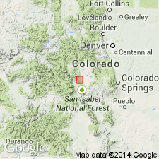
Pg. 973-1009. Newett limestone member of Weber(?) formation. Resistant limestones, light-gray to dark-gray, in layers less than 1 inch to 2 feet thick; dense; with conchoidal fracture. Thickness 20 feet. Liess 330 +/-feet above Leadville limestone (upon which it rests unconformably) and about 1,375 feet below top of Weber(?) formation in Salt Creek area, Park and Chaffee Counties, central Colorado. Age is Pennsylvanian.
Named from abandoned town of Newett, in sec. 3, T. 14 S., R. 77 W., [Castle Rock Gulch 7.5-min quadrangle, Chaffee Co., CO], near which it is exposed.
Source: US geologic names lexicon (USGS Bull. 896, p. 1484).
For more information, please contact Nancy Stamm, Geologic Names Committee Secretary.
Asterisk (*) indicates published by U.S. Geological Survey authors.
"No current usage" (†) implies that a name has been abandoned or has fallen into disuse. Former usage and, if known, replacement name given in parentheses ( ).
Slash (/) indicates name conflicts with nomenclatural guidelines (CSN, 1933; ACSN, 1961, 1970; NACSN, 1983, 2005, 2021). May be explained within brackets ([ ]).