- Usage in publication:
-
- Newburyport Complex*
- Modifications:
-
- Revised
- Age modified
- Geochronologic dating
- AAPG geologic province:
-
- New England province
Summary:
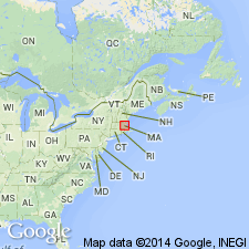
Newburyport Quartz Diorite of Emerson (1917) is renamed Newburyport Complex. Quartz diorite is associated with porphyritic quartz monzonite in the Newburyport area of MA. Under the IUGS rock classification, quartz diorite is a tonalite and a granodiorite, and porphyritic quartz monzonite is a porphyritic granite. These two rocks grade abruptly into each other and are here grouped and renamed. Reevaluation of U-Pb age determinations on zircons from porphyritic quartz monzonite by R.E. Zartman and R.S. Naylor (written commun., 1978; revised by Zartman, written commun., 1981) indicates an Ordovician age. Newburyport Complex intrudes Kittery Formation of Merrimack Group; age of Kittery could be either Silurian or Ordovician or both, which in turn suggests that some of the Newburyport might be Silurian. Therefore, age of Newburyport is revised as Ordovician and Silurian.
Source: GNU records (USGS DDS-6; Reston GNULEX).

- Usage in publication:
-
- Newburyport Complex*
- Modifications:
-
- Overview
- AAPG geologic province:
-
- New England province
Summary:
Used as Newburyport Complex of Ordovician and Silurian age. Divided into a granite unit and a tonalite and granodiorite unit.
Source: GNU records (USGS DDS-6; Reston GNULEX).

- Usage in publication:
-
- Newburyport Complex*
- Modifications:
-
- Revised
- Areal extent
- Geochronologic dating
- AAPG geologic province:
-
- New England province
Summary:
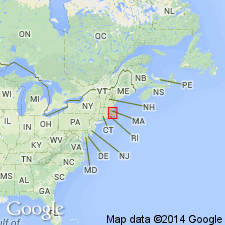
Newburyport Complex was divided into two facies, tonalitic granodiorite and granite, by Shride (1971). Tonalitic facies was originally termed Newburyport Quartz Diorite and included dioritic rocks north of Clinton-Newbury fault zone that are now called Sharpners Pond Diorite in Nashoba zone, and Topsfield Granodiorite in Milford-Dedham zone. These correlations are no longer tenable due to differences in age and composition. Therefore, Newburyport Complex is restricted to the two facies present in Newburyport area. Rocks formerly mapped as Newburyport Quartz Diorite and Salem Gabbro-Diorite, except for gabbros at Salem Neck, MA, are included in undifferentiated diorite and gabbro unit (Zdigb) on MA State Geologic Map (Zen and others, 1983), largely because they could not be separately mapped at 1:250,000 scale. Unit Zdigb also includes mafic dikes and sills that are probably younger or contemporaneous. Most of the dioritic rocks northeast of Boston previously assigned to Newburyport Quartz Diorite are now assigned to an undifferentiated diorite unit (Zdi) on MA State Geologic Map. Newburyport Complex forms a large mass near Newburyport and a small one to its west, both truncated by Clinton-Newbury fault. Tonalite and granodiorite facies occupies core of Newburyport Complex at Newburyport and is intruded to the north by granite facies; described as medium to dark gray in fresh rock, weathering to both green and red, fine to medium grained, and highly variable in mineralogy. A U-Pb zircon age of 455 +/-15 Ma was determined by Zartman and Naylor (1984) for the tonalite. Granite facies intrudes both the Kittery Formation and the tonalite and granodiorite facies and covers an area of about 45 sq km. Described as light gray to dark gray, buff weathering, and porphyritic. No radiometric ages available for granite facies, but it is conceivable that the two facies are different in age. [Papers presented as chapters in U.S. Geological Survey Professional Paper 1366 are intended as explanations and (or) revisions to MA State bedrock geologic map of Zen and others (1983) at scale of 1:250,000.]
Source: GNU records (USGS DDS-6; Reston GNULEX).

- Usage in publication:
-
- Newburyport Complex*
- Modifications:
-
- Overview
- Age modified
- Geochronologic dating
- AAPG geologic province:
-
- New England province
Summary:
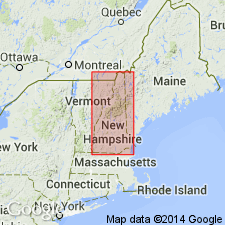
Used as Newburyport Complex in southern NH. Mapped as two bodies; one is medium-grained porphyritic granite, the other is gray, medium-grained tonalite and granodiorite. Age is changed to Late Silurian based on 1) date of 416 +/-1 Ma by U/Pb methods (W.A. Bothner and T.G. Bowring, oral commun., 1994); and 2) work by Bothner and others (1993, Zircon and sphene U/Pb ages of the Exeter pluton: Constraints on the Merrimack Group and part of the Avalon composite terrane [abs.]: Geological Society of America Abstracts with Programs, v. 25, p. 485). Report includes geologic map and correlation chart and 1:500,000-scale map showing plutons and sample localities for age dating.
Source: GNU records (USGS DDS-6; Reston GNULEX).
For more information, please contact Nancy Stamm, Geologic Names Committee Secretary.
Asterisk (*) indicates published by U.S. Geological Survey authors.
"No current usage" (†) implies that a name has been abandoned or has fallen into disuse. Former usage and, if known, replacement name given in parentheses ( ).
Slash (/) indicates name conflicts with nomenclatural guidelines (CSN, 1933; ACSN, 1961, 1970; NACSN, 1983, 2005, 2021). May be explained within brackets ([ ]).

